Jeffs circle route
A cycling route starting in Lemon Grove, California, United States of America.
Overview
About this route
12 mile, partially hilly practice route
- -:--
- Duration
- 19.3 km
- Distance
- 324 m
- Ascent
- 318 m
- Descent
- ---
- Avg. speed
- ---
- Avg. speed
Route quality
Waytypes & surfaces along the route
Waytypes
Quiet road
8.3 km
(43 %)
Road
5.9 km
(31 %)
Surfaces
Paved
13.6 km
(71 %)
Asphalt
13.5 km
(70 %)
Concrete
0.1 km
(<1 %)
Undefined
5.6 km
(29 %)
Continue with Bikemap
Use, edit, or download this cycling route
You would like to ride Jeffs circle route or customize it for your own trip? Here is what you can do with this Bikemap route:
Free features
- Save this route as favorite or in collections
- Copy & plan your own version of this route
- Sync your route with Garmin or Wahoo
Premium features
Free trial for 3 days, or one-time payment. More about Bikemap Premium.
- Navigate this route on iOS & Android
- Export a GPX / KML file of this route
- Create your custom printout (try it for free)
- Download this route for offline navigation
Discover more Premium features.
Get Bikemap PremiumFrom our community
Other popular routes starting in Lemon Grove
- Slow ride in San Diego
- Distance
- 5.2 km
- Ascent
- 8 m
- Descent
- 16 m
- Location
- Lemon Grove, California, United States of America
- Jeffs circle route
- Distance
- 19.3 km
- Ascent
- 324 m
- Descent
- 318 m
- Location
- Lemon Grove, California, United States of America
- Work route
- Distance
- 13.9 km
- Ascent
- 95 m
- Descent
- 232 m
- Location
- Lemon Grove, California, United States of America
- El Cajon Boulevard 6265, San Diego to Unnamed Road, La Mesa
- Distance
- 4.9 km
- Ascent
- 52 m
- Descent
- 25 m
- Location
- Lemon Grove, California, United States of America
- 2322 55th St, San Diego to 1369 Los Coches Ct, Chula Vista
- Distance
- 18.5 km
- Ascent
- 270 m
- Descent
- 223 m
- Location
- Lemon Grove, California, United States of America
- Mildred Way 8210, Lemon Grove to Udall Street 3707, San Diego
- Distance
- 24.8 km
- Ascent
- 43 m
- Descent
- 86 m
- Location
- Lemon Grove, California, United States of America
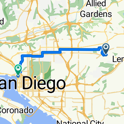
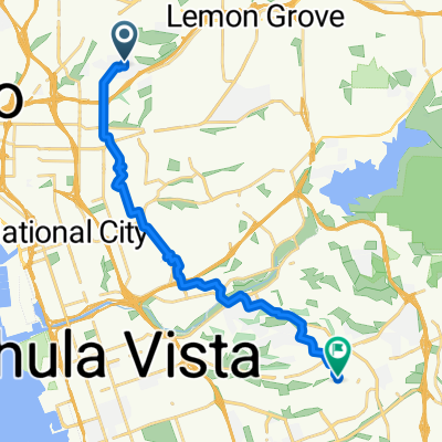
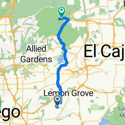
- 6954 Daventry St, Lemon Grove to 9980–10088 Father Junipero Serra Trail, San Diego
- Distance
- 17.4 km
- Ascent
- 266 m
- Descent
- 308 m
- Location
- Lemon Grove, California, United States of America
- Orange and El Cajon Blvd
- Distance
- 19 km
- Ascent
- 170 m
- Descent
- 170 m
- Location
- Lemon Grove, California, United States of America
Open it in the app