

Weber Canyon Rd
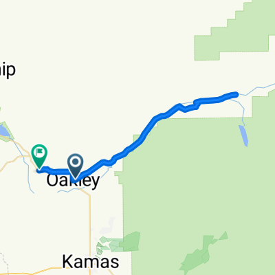
A cycling route starting in Oakley, Utah, United States.
Overview
About this route
Weber Canyon Rd from Peoa. Local pronounce it Weeber. Just sayin'
Park in pull in on side of road in front of LDS marker. At end of road can ride 3 miles on good packed dirt to Smith and Morehouse Reservoir- -:--
- Duration
- 51.3 km
- Distance
- 396 m
- Ascent
- 396 m
- Descent
- ---
- Avg. speed
- ---
- Max. altitude
Route quality
Waytypes & surfaces along the route
Waytypes
Road
40.6 km
(79 %)
Quiet road
7.6 km
(15 %)
Surfaces
Paved
20.3 km
(40 %)
Unpaved
1.4 km
(3 %)
Asphalt
20.3 km
(40 %)
Gravel
1.4 km
(3 %)
Undefined
29.6 km
(58 %)
Continue with Bikemap
Use, edit, or download this cycling route
You would like to ride Weber Canyon Rd or customize it for your own trip? Here is what you can do with this Bikemap route:
Free features
- Save this route as favorite or in collections
- Copy & plan your own version of this route
- Sync your route with Garmin or Wahoo
Premium features
Free trial for 3 days, or one-time payment. More about Bikemap Premium.
- Navigate this route on iOS & Android
- Export a GPX / KML file of this route
- Create your custom printout (try it for free)
- Download this route for offline navigation
Discover more Premium features.
Get Bikemap PremiumFrom our community
Other popular routes starting in Oakley
 From Oakley to Peoa
- Distance
- 43.7 km
- Ascent
- 530 m
- Descent
- 608 m
- Location
- Oakley, Utah, United States
 Moderate route in Oakley
- Distance
- 36.4 km
- Ascent
- 451 m
- Descent
- 369 m
- Location
- Oakley, Utah, United States
 Snyderville - Park City
- Distance
- 18.2 km
- Ascent
- 350 m
- Descent
- 167 m
- Location
- Oakley, Utah, United States
 Weber Canyon Rd
- Distance
- 51.3 km
- Ascent
- 396 m
- Descent
- 396 m
- Location
- Oakley, Utah, United States
 2755 Cottonwood Dr, Coalville to 2325 Sidewinder Dr, Park City
- Distance
- 23.4 km
- Ascent
- 282 m
- Descent
- 21 m
- Location
- Oakley, Utah, United States
Open it in the app