

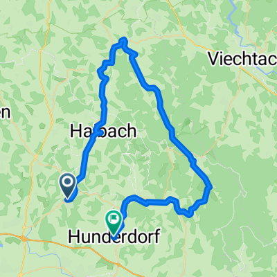
Rund um MItterfels
A cycling route starting in Mitterfels, Bavaria, Germany.
Overview
About this route
Schöne Route mit Ausgangsort Mitterfels. Von hier geht erstmal schön bergab Richtung Ascha um dann wieder Höhenmeter zu gewinnen. Ab Hötzelsdorf geht dann wellig bis über Cham hinaus an den Regen. Hier fahren wir einen Abstecher nach Kötzting um dann den Heimweg einzuschlagen. Besonders schön dabei die Abfahrt ab Konzell. Fahrzeit so ca. 3,5 bis 4 h. Viel Spaß!
- -:--
- Duration
- 91.5 km
- Distance
- 786 m
- Ascent
- 781 m
- Descent
- ---
- Avg. speed
- ---
- Max. altitude
Route quality
Waytypes & surfaces along the route
Waytypes
Busy road
59.9 km
(66 %)
Quiet road
15.2 km
(17 %)
Surfaces
Paved
63.6 km
(70 %)
Unpaved
2.4 km
(3 %)
Asphalt
63.3 km
(69 %)
Unpaved (undefined)
1.6 km
(2 %)
Continue with Bikemap
Use, edit, or download this cycling route
You would like to ride Rund um MItterfels or customize it for your own trip? Here is what you can do with this Bikemap route:
Free features
- Save this route as favorite or in collections
- Copy & plan your own version of this route
- Split it into stages to create a multi-day tour
- Sync your route with Garmin or Wahoo
Premium features
Free trial for 3 days, or one-time payment. More about Bikemap Premium.
- Navigate this route on iOS & Android
- Export a GPX / KML file of this route
- Create your custom printout (try it for free)
- Download this route for offline navigation
Discover more Premium features.
Get Bikemap PremiumFrom our community
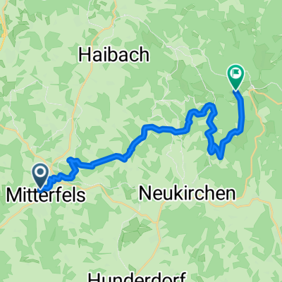
Other popular routes starting in Mitterfels
 Rund um MItterfels
- Distance
- 91.5 km
- Ascent
- 786 m
- Descent
- 781 m
- Location
- Mitterfels, Bavaria, Germany
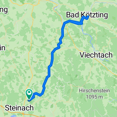 Bad kötzting
- Distance
- 74.7 km
- Ascent
- 836 m
- Descent
- 1,174 m
- Location
- Mitterfels, Bavaria, Germany
 Test 2
- Distance
- 32.5 km
- Ascent
- 564 m
- Descent
- 720 m
- Location
- Mitterfels, Bavaria, Germany
 Mitterfels-Maibrunn
- Distance
- 17.1 km
- Ascent
- 750 m
- Descent
- 328 m
- Location
- Mitterfels, Bavaria, Germany
 Gerade Fahrt in Ascha
- Distance
- 48.3 km
- Ascent
- 420 m
- Descent
- 417 m
- Location
- Mitterfels, Bavaria, Germany
 Mitterfels-Hunderdorf
- Distance
- 50.7 km
- Ascent
- 656 m
- Descent
- 752 m
- Location
- Mitterfels, Bavaria, Germany
 Hubrichstraße 4, Mitterfels nach Hubrichstraße 4, Mitterfels
- Distance
- 5.9 km
- Ascent
- 58 m
- Descent
- 56 m
- Location
- Mitterfels, Bavaria, Germany
 ET2 Mitterfels-Gotteszell
- Distance
- 65.8 km
- Ascent
- 546 m
- Descent
- 390 m
- Location
- Mitterfels, Bavaria, Germany
Open it in the app