

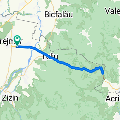
stupini-prejmer-harman-podul olt-lunca calnicului-prejmer-stupini
A cycling route starting in Prejmer, Brașov County, Romania.
Overview
About this route
drum preponderent asfalt, macadam in zona DJ112 Podul Oltului - DN11 Lunca Calnicului
- -:--
- Duration
- 30.2 km
- Distance
- 53 m
- Ascent
- 51 m
- Descent
- ---
- Avg. speed
- ---
- Max. altitude

Route quality
Waytypes & surfaces along the route
Waytypes
Quiet road
4.5 km
(15 %)
Track
2.4 km
(8 %)
Surfaces
Paved
25.4 km
(84 %)
Unpaved
3.6 km
(12 %)
Asphalt
25.4 km
(84 %)
Gravel
2.1 km
(7 %)
Continue with Bikemap
Use, edit, or download this cycling route
You would like to ride stupini-prejmer-harman-podul olt-lunca calnicului-prejmer-stupini or customize it for your own trip? Here is what you can do with this Bikemap route:
Free features
- Save this route as favorite or in collections
- Copy & plan your own version of this route
- Sync your route with Garmin or Wahoo
Premium features
Free trial for 3 days, or one-time payment. More about Bikemap Premium.
- Navigate this route on iOS & Android
- Export a GPX / KML file of this route
- Create your custom printout (try it for free)
- Download this route for offline navigation
Discover more Premium features.
Get Bikemap PremiumFrom our community
Other popular routes starting in Prejmer
 Prejmer - Bv - Timisul de Sus - Cabana Tamina - Vf.Piatra Mare - Susai - Garcin - Sacele Tarlungeni - Carpinis - Prejmer
- Distance
- 84.4 km
- Ascent
- 1,130 m
- Descent
- 1,130 m
- Location
- Prejmer, Brașov County, Romania
 Sepsi-Döblön-Bodzavám - körtúra
- Distance
- 89.6 km
- Ascent
- 652 m
- Descent
- 629 m
- Location
- Prejmer, Brașov County, Romania
 prejmer-teliu-dobarlau-bicfalau-ozun-lunca calnicului-prejmer
- Distance
- 30.9 km
- Ascent
- 71 m
- Descent
- 71 m
- Location
- Prejmer, Brașov County, Romania
 Stupinii prejmerului - Teliu - Limita de judet si retur
- Distance
- 32.2 km
- Ascent
- 330 m
- Descent
- 327 m
- Location
- Prejmer, Brașov County, Romania
 Sunday bike trip
- Distance
- 160.8 km
- Ascent
- 802 m
- Descent
- 1,137 m
- Location
- Prejmer, Brașov County, Romania
 Stupini-Teliu-Dobarlau-Bicfalau-Ozun-Lunca Calnicului-Prejmer-Stupini
- Distance
- 31.2 km
- Ascent
- 56 m
- Descent
- 56 m
- Location
- Prejmer, Brașov County, Romania
 Tarlungeni-Dalghiu-Vama Buzaului-Bradet-Teliu
- Distance
- 74.4 km
- Ascent
- 736 m
- Descent
- 737 m
- Location
- Prejmer, Brașov County, Romania
 Pe valea Dobârlăului prin Intorsura si DN10
- Distance
- 62.2 km
- Ascent
- 431 m
- Descent
- 434 m
- Location
- Prejmer, Brașov County, Romania
Open it in the app