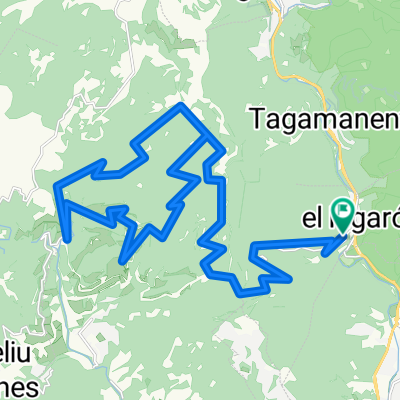
Samalus-Collformic-Tagamanent
- 95.3 km
- 1,653 m
- 1,423 m
- Figaró, Catalonia, Spain
A cycling route starting in Figaró, Catalonia, Spain.
Overview
Route combining very tough tracks with flat stretches, linking in Collfornic to the road for the descent to Sant Celoni.
The first section, starting in the town of Figaró, is on a very narrow trail following the stream, with several options (crossing the stream at the beginning, middle or end). The good part starts right away, with very steep ramps gaining altitude quickly. Hairpin bends are a sign of gaining elevation. Upon reaching L'Estepar, it is advisable to stop and look back to contemplate what we left below (and what still lies ahead to climb...).
Arrival at Tagamanent, where lunch is well deserved. From there, the path heads towards Pla de la Calma, where the vegetation gradually disappears, but altitude is still gained...
The Collfornic crossing is unmistakable. Spectacular views of the Olla del Montseny. And now, the long-awaited descent to Sant Celoni. On asphalt, we will not leave the Montseny Natural Park until reaching its foothills. The alternative for the brave is halfway down the descent, in the town of Montseny. From there, you can take the road that goes to Costa de Monseny and, I repeat, for those brave enough to tackle the climb to Turó de l'Home.
We descend along the right bank of the Tordera to Santa Maria de Palautordera, where we cross the river and the AVE line. Finally, arrival in Sant Celoni.
created this 11 years ago
Route quality
Road
22.8 km
50 %
Track
13.2 km
29 %
Paved
3.7 km
(8 %)
Unpaved
8.2 km
(18 %)
Gravel
3.2 km
7 %
Asphalt
2.7 km
6 %
Continue with Bikemap
You would like to ride Figaró - Sant Celoni (por Tagamanent) or customize it for your own trip? Here is what you can do with this Bikemap route:
Free trial for 3 days, or one-time payment. More about Bikemap Premium.
Discover more Premium features.
Get Bikemap PremiumFrom our community
Open it in the app