

Erft - Radweg
A cycling route starting in Euskirchen, North Rhine-Westphalia, Germany.
Overview
About this route
Erft-Radweg,
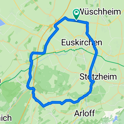
Wer die ebene Landschaft liebt, wer abseits der Straße unmittelbar neben einem Fluss entlang fahren möchte, wer sich von ungezählten Wasserburgen beeindrucken lässt der ist auf dem Erft-Radweg genau richtig. Die Strecke ist auf Grund Ihrer Topographie besonders für Familien geeignet. Auf einer Strecke von rund 64 km verläuft der Erft-Radweg nahezu durchgängig neben dem Fluss. Region: Nordrhein-Westfalen Startpunkt: Euskirchen - Bhf. Ende: Grevenbrich Bhf. Ort entlage der Tour: Euskirche Bahnhof, Kessenich, Weilerswist, Bliesheim, Blessem, Turnich, Quadrat-Ichendorf, Bergheim, Glech, Bedburg, Frimmersdorf, Gustorf, Grevenbroich.- -:--
- Duration
- 64.3 km
- Distance
- 14 m
- Ascent
- 129 m
- Descent
- ---
- Avg. speed
- ---
- Max. altitude

Route highlights
Points of interest along the route

Photo after 3.2 km
Kessenicherburg

Photo after 5.5 km
Erft

Photo after 10.6 km
Ruine in Groß-Vernich

Photo after 13.3 km
Erft-Auen bei Weilerswist

Photo after 20.2 km
The White House of Blessem

Photo after 24.3 km
Erft Radweg

Photo after 26.9 km
Schloss Türnich
Continue with Bikemap
Use, edit, or download this cycling route
You would like to ride Erft - Radweg or customize it for your own trip? Here is what you can do with this Bikemap route:
Free features
- Save this route as favorite or in collections
- Copy & plan your own version of this route
- Sync your route with Garmin or Wahoo
Premium features
Free trial for 3 days, or one-time payment. More about Bikemap Premium.
- Navigate this route on iOS & Android
- Export a GPX / KML file of this route
- Create your custom printout (try it for free)
- Download this route for offline navigation
Discover more Premium features.
Get Bikemap PremiumFrom our community
Other popular routes starting in Euskirchen
 Rund um Euskirchen
- Distance
- 28.7 km
- Ascent
- 122 m
- Descent
- 117 m
- Location
- Euskirchen, North Rhine-Westphalia, Germany
 MTB tour der hoffnung ca. 48KM 800HM
- Distance
- 47.5 km
- Ascent
- 682 m
- Descent
- 689 m
- Location
- Euskirchen, North Rhine-Westphalia, Germany
 Rodderbach 55, Euskirchen nach Rodderbach 55, Euskirchen
- Distance
- 19.1 km
- Ascent
- 160 m
- Descent
- 157 m
- Location
- Euskirchen, North Rhine-Westphalia, Germany
 2025_2 Euskirchen bis Aachen
- Distance
- 74.2 km
- Ascent
- 716 m
- Descent
- 700 m
- Location
- Euskirchen, North Rhine-Westphalia, Germany
 EU-Abendroute (westlich EU)
- Distance
- 20.4 km
- Ascent
- 93 m
- Descent
- 91 m
- Location
- Euskirchen, North Rhine-Westphalia, Germany
 Rund um Euskirchen
- Distance
- 28.8 km
- Ascent
- 142 m
- Descent
- 137 m
- Location
- Euskirchen, North Rhine-Westphalia, Germany
 EU-Bad Münstereifel-Mechernich: Waldtour
- Distance
- 43.1 km
- Ascent
- 413 m
- Descent
- 404 m
- Location
- Euskirchen, North Rhine-Westphalia, Germany
 EU-BAM-Forstgebiete-Arloff-EU
- Distance
- 39.1 km
- Ascent
- 290 m
- Descent
- 291 m
- Location
- Euskirchen, North Rhine-Westphalia, Germany
Open it in the app