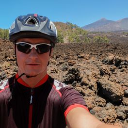
Canadas-Höhenweg-Roque de la Grieta
A cycling route starting in Realejo Alto, Canary Islands, Spain.
Overview
About this route
von Kermit
(cloned from route 1971509)
- -:--
- Duration
- 33.6 km
- Distance
- 685 m
- Ascent
- 684 m
- Descent
- ---
- Avg. speed
- ---
- Max. altitude
Continue with Bikemap
Use, edit, or download this cycling route
You would like to ride Canadas-Höhenweg-Roque de la Grieta or customize it for your own trip? Here is what you can do with this Bikemap route:
Free features
- Save this route as favorite or in collections
- Copy & plan your own version of this route
- Sync your route with Garmin or Wahoo
Premium features
Free trial for 3 days, or one-time payment. More about Bikemap Premium.
- Navigate this route on iOS & Android
- Export a GPX / KML file of this route
- Create your custom printout (try it for free)
- Download this route for offline navigation
Discover more Premium features.
Get Bikemap PremiumFrom our community
Other popular routes starting in Realejo Alto
 Kraterrandrunde nach El Medano
- Distance
- 57.3 km
- Ascent
- 512 m
- Descent
- 2,545 m
- Location
- Realejo Alto, Canary Islands, Spain
 vuelta teide
- Distance
- 157.3 km
- Ascent
- 3,359 m
- Descent
- 3,361 m
- Location
- Realejo Alto, Canary Islands, Spain
 20151208 El Portillo Mdor Chio Llanos del Hospital Bco de la Arena Piedra de Los Pastores
- Distance
- 69.6 km
- Ascent
- 1,381 m
- Descent
- 1,391 m
- Location
- Realejo Alto, Canary Islands, Spain
 teide2
- Distance
- 69.7 km
- Ascent
- 1,211 m
- Descent
- 1,205 m
- Location
- Realejo Alto, Canary Islands, Spain
 Canadas-Höhenweg-Roque de la Grieta
- Distance
- 33.6 km
- Ascent
- 684 m
- Descent
- 684 m
- Location
- Realejo Alto, Canary Islands, Spain
 20151208 El Portillo Mdor Chio Llanos del Hospital Pista del Agujero Piedra de Los Pastores
- Distance
- 71.4 km
- Ascent
- 1,147 m
- Descent
- 1,151 m
- Location
- Realejo Alto, Canary Islands, Spain
 P. Teide: Oben auf dem Rand der Caldera
- Distance
- 53.3 km
- Ascent
- 542 m
- Descent
- 2,554 m
- Location
- Realejo Alto, Canary Islands, Spain
 Dx - Teide Hochebene
- Distance
- 11.4 km
- Ascent
- 448 m
- Descent
- 149 m
- Location
- Realejo Alto, Canary Islands, Spain
Open it in the app


