

Kylltal-Radweg
A cycling route starting in Kerschenbach, Rhineland-Palatinate, Germany.
Overview
About this route
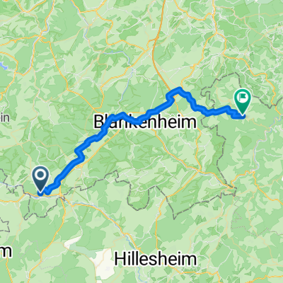
The Kyll Valley Cycle Route connects the source of the Kyll River at Losheimergraben on the German-Belgian border with its confluence into the Moselle at Trier-Ehrang and the Roman city of Trier, located just a few kilometers away. The very scenic, 111 km long cycle path follows the course of the wild and romantic Eifel river Kyll. It passes numerous castles, mills, and picturesque Eifel villages and crosses several Eifel landscapes. For almost the entire length (from Jünkerath to Trier) the cycle path runs alongside the railway. Most of the route is flat to hilly. A steep climb (>10%) lies between Kyllburg and Bitburg-Erdorf. However, this section can be bypassed by train. The route is mostly paved, with the remaining parts on surfaced paths. The cycle path is recommended for leisure cyclists interested in nature and culture. Between Gerolstein-Bewingen and Densborn, an almost flat approximately 20 km long children's cycle path has been established.
- -:--
- Duration
- 111.1 km
- Distance
- 331 m
- Ascent
- 675 m
- Descent
- ---
- Avg. speed
- ---
- Max. altitude
Route highlights
Points of interest along the route

Point of interest after 33.1 km
Die Burg Lissingen an der Kyll ist eine gut erhaltene, ehemalige Wasserburg aus dem 13. Jahrhundert bei Gerolstein. Sie wirkt von außen wie eine einzige Burg, ist aber eine Doppelburg. Sie besteht aufgrund einer Teilung im Jahre 1559 aus einer sog. Unterburg (Niederburg) und einer Oberburg, die auch

Point of interest after 79.6 km
Wallfahrtskirche in Auw Die Pfarrkirche Maria Himmelfahrt in Auw ist eine der ältesten und schönsten Kirchen in der Südeifelregion. Seit jeher prägte sie das Bild des kleinen Ortes in der Eifel mit ihrer zentralen, hochgelegenen Position inmitten des Dorfes im Kylltal. Ihre Wurzeln reichen zurück bi

Point of interest after 111.1 km
Porta Nigra

Point of interest after 111.1 km
Kaiserthermen

Point of interest after 111.1 km
Konstantin-Basilika

Point of interest after 111.1 km
Das Welterbe Römische Baudenkmäler, Dom und Liebfrauenkirche in Trier bezeichnet eine Reihe von römischen und mittelalterlichen Kulturdenkmälern in Trier sowie in der Trierer Nachbargemeinde Igel, die 1986 in die Liste des Weltkulturerbes der UNESCO aufgenommen wurden. Das im Jahr 16 v. Chr. als Aug
Continue with Bikemap
Use, edit, or download this cycling route
You would like to ride Kylltal-Radweg or customize it for your own trip? Here is what you can do with this Bikemap route:
Free features
- Save this route as favorite or in collections
- Copy & plan your own version of this route
- Split it into stages to create a multi-day tour
- Sync your route with Garmin or Wahoo
Premium features
Free trial for 3 days, or one-time payment. More about Bikemap Premium.
- Navigate this route on iOS & Android
- Export a GPX / KML file of this route
- Create your custom printout (try it for free)
- Download this route for offline navigation
Discover more Premium features.
Get Bikemap PremiumFrom our community
Other popular routes starting in Kerschenbach
 SoTo 2018/19: Kronenburg - Heimbach
- Distance
- 91.4 km
- Ascent
- 389 m
- Descent
- 649 m
- Location
- Kerschenbach, Rhineland-Palatinate, Germany
 Kron-ri gerolstein mtb 53km
- Distance
- 53.8 km
- Ascent
- 674 m
- Descent
- 672 m
- Location
- Kerschenbach, Rhineland-Palatinate, Germany
 0627Di: Kronenburg-Monschau
- Distance
- 53.9 km
- Ascent
- 245 m
- Descent
- 381 m
- Location
- Kerschenbach, Rhineland-Palatinate, Germany
 Burgbering, Dahlem nach Nordstraße, Wershofen
- Distance
- 37.1 km
- Ascent
- 523 m
- Descent
- 582 m
- Location
- Kerschenbach, Rhineland-Palatinate, Germany
 Baasem-Stadtkyll-Jünkerath
- Distance
- 20.2 km
- Ascent
- 215 m
- Descent
- 214 m
- Location
- Kerschenbach, Rhineland-Palatinate, Germany
 2020 Vennquerbahn Kronenburg
- Distance
- 26.6 km
- Ascent
- 226 m
- Descent
- 226 m
- Location
- Kerschenbach, Rhineland-Palatinate, Germany
 Kron-ri gerolstein mtb 53km
- Distance
- 53.8 km
- Ascent
- 684 m
- Descent
- 682 m
- Location
- Kerschenbach, Rhineland-Palatinate, Germany
 Kronenburg- Himmerod
- Distance
- 72.6 km
- Ascent
- 336 m
- Descent
- 519 m
- Location
- Kerschenbach, Rhineland-Palatinate, Germany
Open it in the app