
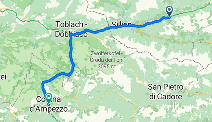
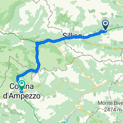
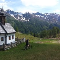
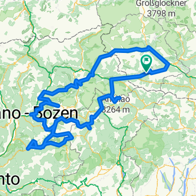
7. Etappe_Mittenwald an der Drau-Cortina d'Ampezzo
A cycling route starting in Anras, Tyrol, Austria.
Overview
About this route
- Stage_Mittenwald an der Drau-Cortina d'Ampezzo
- -:--
- Duration
- 62.8 km
- Distance
- 671 m
- Ascent
- 326 m
- Descent
- ---
- Avg. speed
- ---
- Max. altitude

Route quality
Waytypes & surfaces along the route
Waytypes
Cycleway
40.2 km
(64 %)
Track
11.3 km
(18 %)
Surfaces
Paved
39.6 km
(63 %)
Unpaved
22 km
(35 %)
Asphalt
35.8 km
(57 %)
Gravel
17 km
(27 %)
Continue with Bikemap
Use, edit, or download this cycling route
You would like to ride 7. Etappe_Mittenwald an der Drau-Cortina d'Ampezzo or customize it for your own trip? Here is what you can do with this Bikemap route:
Free features
- Save this route as favorite or in collections
- Copy & plan your own version of this route
- Sync your route with Garmin or Wahoo
Premium features
Free trial for 3 days, or one-time payment. More about Bikemap Premium.
- Navigate this route on iOS & Android
- Export a GPX / KML file of this route
- Create your custom printout (try it for free)
- Download this route for offline navigation
Discover more Premium features.
Get Bikemap PremiumFrom our community
Other popular routes starting in Anras
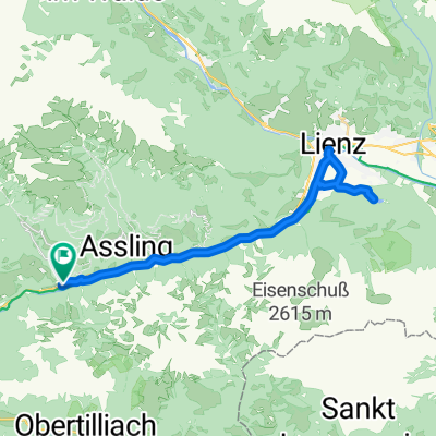
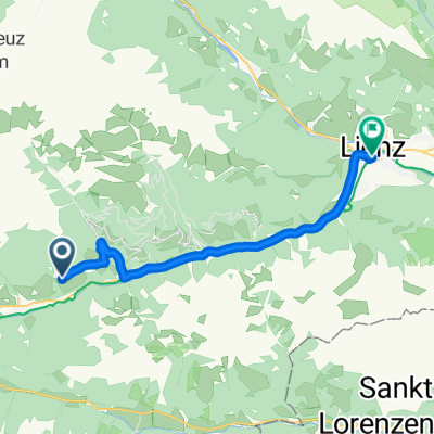 10/08 Anras - Lienz
- Distance
- 22.2 km
- Ascent
- 99 m
- Descent
- 661 m
- Location
- Anras, Tyrol, Austria
 7. Etappe_Mittenwald an der Drau-Cortina d'Ampezzo
- Distance
- 62.8 km
- Ascent
- 671 m
- Descent
- 326 m
- Location
- Anras, Tyrol, Austria
 RBRrower-dzien 6-03.08.16
- Distance
- 161.8 km
- Ascent
- 451 m
- Descent
- 1,057 m
- Location
- Anras, Tyrol, Austria
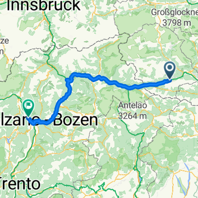
 Anras - Mühldorf
- Distance
- 91 km
- Ascent
- 1,099 m
- Descent
- 1,422 m
- Location
- Anras, Tyrol, Austria
 Burg - Gölbnerblickhütte
- Distance
- 17.1 km
- Ascent
- 556 m
- Descent
- 541 m
- Location
- Anras, Tyrol, Austria
 Mittewald 156, Mittewald an der Drau nach Mittewald 154, Mittewald an der Drau
- Distance
- 37.5 km
- Ascent
- 2,346 m
- Descent
- 2,340 m
- Location
- Anras, Tyrol, Austria
 1. Etappe - 7. Alpentour
- Distance
- 101.3 km
- Ascent
- 1,469 m
- Descent
- 1,633 m
- Location
- Anras, Tyrol, Austria
 7 Alpentour gesamt
- Distance
- 545.8 km
- Ascent
- 7,924 m
- Descent
- 7,988 m
- Location
- Anras, Tyrol, Austria
Open it in the app