

SAINT DIDIER SAINT REMY
A cycling route starting in Saint-Didier, Provence-Alpes-Côte d'Azur Region, France.
Overview
About this route
Les alpilles depart saint didier et val d'enfer
- -:--
- Duration
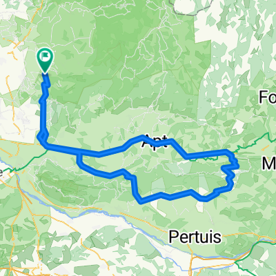
- 124.8 km
- Distance
- 588 m
- Ascent
- 571 m
- Descent
- ---
- Avg. speed
- ---
- Max. altitude

Route quality
Waytypes & surfaces along the route
Waytypes
Road
58.1 km
(47 %)
Busy road
57.1 km
(46 %)
Surfaces
Paved
106.8 km
(86 %)
Unpaved
0.2 km
(<1 %)
Asphalt
106.6 km
(85 %)
Gravel
0.2 km
(<1 %)
Continue with Bikemap
Use, edit, or download this cycling route
You would like to ride SAINT DIDIER SAINT REMY or customize it for your own trip? Here is what you can do with this Bikemap route:
Free features
- Save this route as favorite or in collections
- Copy & plan your own version of this route
- Split it into stages to create a multi-day tour
- Sync your route with Garmin or Wahoo
Premium features
Free trial for 3 days, or one-time payment. More about Bikemap Premium.
- Navigate this route on iOS & Android
- Export a GPX / KML file of this route
- Create your custom printout (try it for free)
- Download this route for offline navigation
Discover more Premium features.
Get Bikemap PremiumFrom our community
Other popular routes starting in Saint-Didier
 Les Indochinois
- Distance
- 91.7 km
- Ascent
- 917 m
- Descent
- 916 m
- Location
- Saint-Didier, Provence-Alpes-Côte d'Azur Region, France
 Saint Didier Lioux
- Distance
- 85.4 km
- Ascent
- 918 m
- Descent
- 912 m
- Location
- Saint-Didier, Provence-Alpes-Côte d'Azur Region, France
 Saint Didier Beaumont du Ventoux
- Distance
- 75 km
- Ascent
- 646 m
- Descent
- 643 m
- Location
- Saint-Didier, Provence-Alpes-Côte d'Azur Region, France
 Col de Murs 78km
- Distance
- 77.8 km
- Ascent
- 1,425 m
- Descent
- 1,422 m
- Location
- Saint-Didier, Provence-Alpes-Côte d'Azur Region, France
 GRAND LUBERON
- Distance
- 161.6 km
- Ascent
- 1,231 m
- Descent
- 1,228 m
- Location
- Saint-Didier, Provence-Alpes-Côte d'Azur Region, France
 180407
- Distance
- 81.8 km
- Ascent
- 936 m
- Descent
- 952 m
- Location
- Saint-Didier, Provence-Alpes-Côte d'Azur Region, France
 Col de l'Aire dei Masco
- Distance
- 152 km
- Ascent
- 1,312 m
- Descent
- 1,312 m
- Location
- Saint-Didier, Provence-Alpes-Côte d'Azur Region, France
 SAINT DIDIER SAINT REMY
- Distance
- 124.8 km
- Ascent
- 588 m
- Descent
- 571 m
- Location
- Saint-Didier, Provence-Alpes-Côte d'Azur Region, France
Open it in the app