

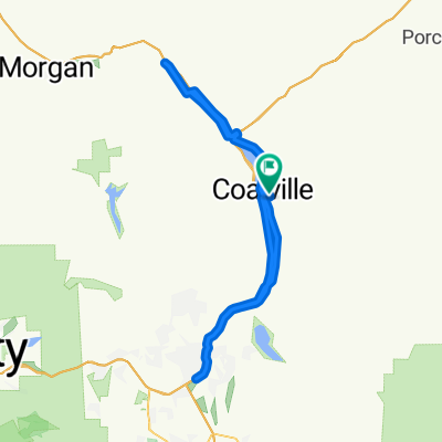
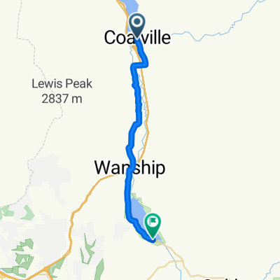
Wanship-Kamas Valley
A cycling route starting in Coalville, Utah, United States.
Overview
About this route
park at Wanship cemetery. Plenty of room.
Port-a-johns shortly after you start the ride on side of lake. Lots of small, untravelled back roads. Not much climbing. There is a short section of dirt that is good. Food stop in Kamas on SR 32 - cafe, coffee, sandwiches.- -:--
- Duration
- 72.6 km
- Distance
- 347 m
- Ascent
- 362 m
- Descent
- ---
- Avg. speed
- ---
- Max. altitude
Route quality
Waytypes & surfaces along the route
Waytypes
Quiet road
26.8 km
(37 %)
Road
12.3 km
(17 %)
Surfaces
Paved
58.1 km
(80 %)
Unpaved
2.9 km
(4 %)
Asphalt
58.1 km
(80 %)
Gravel
2.9 km
(4 %)
Undefined
11.6 km
(16 %)
Continue with Bikemap
Use, edit, or download this cycling route
You would like to ride Wanship-Kamas Valley or customize it for your own trip? Here is what you can do with this Bikemap route:
Free features
- Save this route as favorite or in collections
- Copy & plan your own version of this route
- Sync your route with Garmin or Wahoo
Premium features
Free trial for 3 days, or one-time payment. More about Bikemap Premium.
- Navigate this route on iOS & Android
- Export a GPX / KML file of this route
- Create your custom printout (try it for free)
- Download this route for offline navigation
Discover more Premium features.
Get Bikemap PremiumFrom our community
Other popular routes starting in Coalville
 Wanship-Kamas Valley
- Distance
- 72.6 km
- Ascent
- 347 m
- Descent
- 362 m
- Location
- Coalville, Utah, United States
 CROYDON DEATH LOOP
- Distance
- 17.3 km
- Ascent
- ---
- Descent
- ---
- Location
- Coalville, Utah, United States
 Browns Cyn - Echo Res.
- Distance
- 88.3 km
- Ascent
- 788 m
- Descent
- 709 m
- Location
- Coalville, Utah, United States
 North Uinta
- Distance
- 297.4 km
- Ascent
- 2,692 m
- Descent
- 2,770 m
- Location
- Coalville, Utah, United States
 Wanship to Echo
- Distance
- 19.9 km
- Ascent
- 110 m
- Descent
- 24 m
- Location
- Coalville, Utah, United States
 Pioneer Drive to Pioneer Drive
- Distance
- 96.6 km
- Ascent
- 542 m
- Descent
- 522 m
- Location
- Coalville, Utah, United States
 Coalville - Snyderville
- Distance
- 21.4 km
- Ascent
- 379 m
- Descent
- 226 m
- Location
- Coalville, Utah, United States

Edge1000®
Coalville Cycling- Distance
- 65 km
- Ascent
- 303 m
- Descent
- 293 m
- Location
- Coalville, Utah, United States
Open it in the app