

Przełęcz karkonowska od strony czeskiej
A cycling route starting in Podgórzyn, Lower Silesian Voivodeship, Poland.
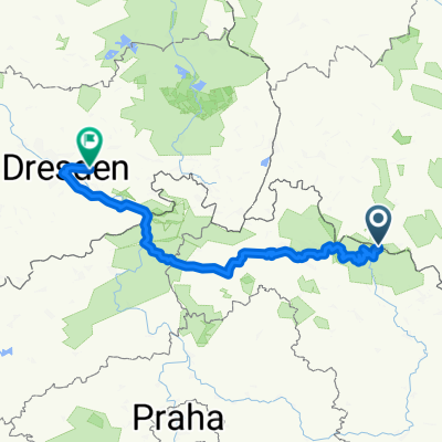
Overview
About this route
Three very steep sections. A demanding route for road cyclists due to sharp gradients, and for mountain bikers because of the route's length. The route is passable both ways over the Karkonosze Pass only for the best road cyclists!
- -:--
- Duration
- 113.9 km
- Distance
- 2,570 m
- Ascent
- 2,243 m
- Descent
- ---
- Avg. speed
- 1,100 m
- Max. altitude
Route quality
Waytypes & surfaces along the route
Waytypes
Track
17.1 km
(15 %)
Quiet road
14.8 km
(13 %)
Surfaces
Paved
74 km
(65 %)
Unpaved
12.5 km
(11 %)
Asphalt
74 km
(65 %)
Ground
5.7 km
(5 %)
Route highlights
Points of interest along the route
Point of interest after 15.2 km
Słynny polski ORLINEK
Point of interest after 99.3 km
Piękne serpentynki ;)
Continue with Bikemap
Use, edit, or download this cycling route
You would like to ride Przełęcz karkonowska od strony czeskiej or customize it for your own trip? Here is what you can do with this Bikemap route:
Free features
- Save this route as favorite or in collections
- Copy & plan your own version of this route
- Split it into stages to create a multi-day tour
- Sync your route with Garmin or Wahoo
Premium features
Free trial for 3 days, or one-time payment. More about Bikemap Premium.
- Navigate this route on iOS & Android
- Export a GPX / KML file of this route
- Create your custom printout (try it for free)
- Download this route for offline navigation
Discover more Premium features.
Get Bikemap PremiumFrom our community
Other popular routes starting in Podgórzyn
 Krkonošská pivní stezka
- Distance
- 30.1 km
- Ascent
- 543 m
- Descent
- 1,266 m
- Location
- Podgórzyn, Lower Silesian Voivodeship, Poland
 Mushrooming trip in Karkonosze Mts
- Distance
- 19.4 km
- Ascent
- 507 m
- Descent
- 507 m
- Location
- Podgórzyn, Lower Silesian Voivodeship, Poland
 09.09.2020 SINGLE Olbrzymy
- Distance
- 22.2 km
- Ascent
- 310 m
- Descent
- 309 m
- Location
- Podgórzyn, Lower Silesian Voivodeship, Poland
 Krkonošská pivní stezka - Špindlerovka - Slezský dům - Sněžka - Luční bouda - Friesovy boudy - Pivovar Hendrych - Vrchlabí
- Distance
- 32.4 km
- Ascent
- 625 m
- Descent
- 1,340 m
- Location
- Podgórzyn, Lower Silesian Voivodeship, Poland
 przełecz karkonoska
- Distance
- 9.4 km
- Ascent
- 774 m
- Descent
- 34 m
- Location
- Podgórzyn, Lower Silesian Voivodeship, Poland
 2014-06-19 Riesengebirge (Rund um die Schneekoppe)
- Distance
- 22.7 km
- Ascent
- 779 m
- Descent
- 1,085 m
- Location
- Podgórzyn, Lower Silesian Voivodeship, Poland
 07.04.19 Lucni Bouda
- Distance
- 27.7 km
- Ascent
- 1,470 m
- Descent
- 1,351 m
- Location
- Podgórzyn, Lower Silesian Voivodeship, Poland
 Riesengebirge Tag 3
- Distance
- 248.6 km
- Ascent
- 3,617 m
- Descent
- 4,662 m
- Location
- Podgórzyn, Lower Silesian Voivodeship, Poland
Open it in the app