

anjala-kannusjärvi-hamina-anajala
A cycling route starting in Anjala, Kymenlaakso, Finland.
Overview
About this route
kiva reitti :)
- -:--
- Duration
- 36.4 km
- Distance
- 185 m
- Ascent
- 187 m
- Descent
- ---
- Avg. speed
- ---
- Max. altitude

Route quality
Waytypes & surfaces along the route
Waytypes
Road
20.8 km
(57 %)
Track
1.1 km
(3 %)
Surfaces
Paved
24.4 km
(67 %)
Unpaved
3.6 km
(10 %)
Asphalt
24.4 km
(67 %)
Unpaved (undefined)
3.6 km
(10 %)
Undefined
8.4 km
(23 %)
Continue with Bikemap
Use, edit, or download this cycling route
You would like to ride anjala-kannusjärvi-hamina-anajala or customize it for your own trip? Here is what you can do with this Bikemap route:
Free features
- Save this route as favorite or in collections
- Copy & plan your own version of this route
- Sync your route with Garmin or Wahoo
Premium features
Free trial for 3 days, or one-time payment. More about Bikemap Premium.
- Navigate this route on iOS & Android
- Export a GPX / KML file of this route
- Create your custom printout (try it for free)
- Download this route for offline navigation
Discover more Premium features.
Get Bikemap PremiumFrom our community
Other popular routes starting in Anjala
 anjala-kannusjärvi-hamina-anajala
- Distance
- 36.4 km
- Ascent
- 185 m
- Descent
- 187 m
- Location
- Anjala, Kymenlaakso, Finland
 inkeroisiin anjanlan abc:n kautta
- Distance
- 35.3 km
- Ascent
- 197 m
- Descent
- 197 m
- Location
- Anjala, Kymenlaakso, Finland
 liikkala-kouvola-liikkala
- Distance
- 73.5 km
- Ascent
- 240 m
- Descent
- 240 m
- Location
- Anjala, Kymenlaakso, Finland
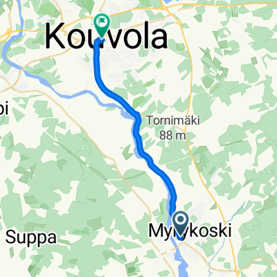 Karjalantie, Myllykoski to Torikatu, Kouvola
- Distance
- 14.5 km
- Ascent
- 90 m
- Descent
- 47 m
- Location
- Anjala, Kymenlaakso, Finland
 Myllykoski-Liponkuja
- Distance
- 12.5 km
- Ascent
- 48 m
- Descent
- 26 m
- Location
- Anjala, Kymenlaakso, Finland
Open it in the app