

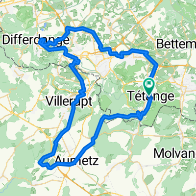
2013 64th Flèche du Sud Stage 4
A cycling route starting in Tétange, District de Luxembourg, Luxembourg.
Overview
About this route
<h2 style="margin: -4px 0px 10px; padding: 0px; border: 0px; outline: 0px; font-size: 21px; font-family: tahoma; color: rgb(0, 0, 0);"> <font class="blue" style="color: rgb(27, 155, 224);">Stage 4</font> » <font class="red" style="color: rgb(236, 56, 56);">Kayl › Soleuvre</font></h2>
- -:--
- Duration
- 121.9 km
- Distance
- 812 m
- Ascent
- 744 m
- Descent
- ---
- Avg. speed
- ---
- Max. altitude
Route quality
Waytypes & surfaces along the route
Waytypes
Quiet road
8.5 km
(7 %)
Cycleway
4.9 km
(4 %)
Surfaces
Paved
117 km
(96 %)
Unpaved
2.4 km
(2 %)
Asphalt
115.8 km
(95 %)
Paved (undefined)
1.2 km
(1 %)
Continue with Bikemap
Use, edit, or download this cycling route
You would like to ride 2013 64th Flèche du Sud Stage 4 or customize it for your own trip? Here is what you can do with this Bikemap route:
Free features
- Save this route as favorite or in collections
- Copy & plan your own version of this route
- Split it into stages to create a multi-day tour
- Sync your route with Garmin or Wahoo
Premium features
Free trial for 3 days, or one-time payment. More about Bikemap Premium.
- Navigate this route on iOS & Android
- Export a GPX / KML file of this route
- Create your custom printout (try it for free)
- Download this route for offline navigation
Discover more Premium features.
Get Bikemap PremiumFrom our community
Other popular routes starting in Tétange
 Rue de la Fontaine nach Rue de la Fontaine
- Distance
- 57.6 km
- Ascent
- 706 m
- Descent
- 708 m
- Location
- Tétange, District de Luxembourg, Luxembourg
 Tétange - Belval - Sanem - Tétange
- Distance
- 40.1 km
- Ascent
- 434 m
- Descent
- 433 m
- Location
- Tétange, District de Luxembourg, Luxembourg
 Von Tetingen bis Remich
- Distance
- 83 km
- Ascent
- 1,071 m
- Descent
- 1,072 m
- Location
- Tétange, District de Luxembourg, Luxembourg
 Rue des Martyrs, Tétange a Rue des Martyrs, Tétange
- Distance
- 83.6 km
- Ascent
- 799 m
- Descent
- 799 m
- Location
- Tétange, District de Luxembourg, Luxembourg
 Ouschtertour
- Distance
- 19.8 km
- Ascent
- 140 m
- Descent
- 143 m
- Location
- Tétange, District de Luxembourg, Luxembourg
 De Tétange à Belval
- Distance
- 35.3 km
- Ascent
- 484 m
- Descent
- 503 m
- Location
- Tétange, District de Luxembourg, Luxembourg
 2013 64th Flèche du Sud Stage 4
- Distance
- 121.9 km
- Ascent
- 812 m
- Descent
- 744 m
- Location
- Tétange, District de Luxembourg, Luxembourg
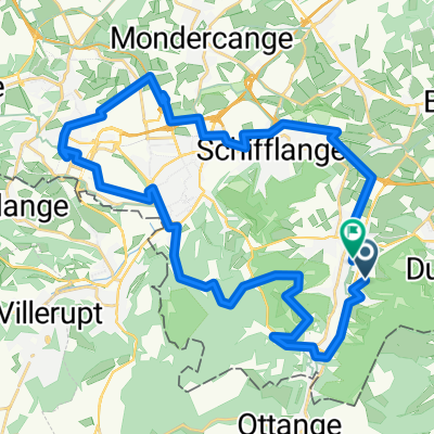
 Tétange - Belval - Differdange - Sanem - Tétange
- Distance
- 51.8 km
- Ascent
- 502 m
- Descent
- 502 m
- Location
- Tétange, District de Luxembourg, Luxembourg
Open it in the app