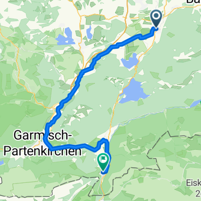
Voralpentour
A cycling route starting in Benediktbeuern, Bavaria, Germany.
Overview
About this route
B'beuern-Walchensee-Jachenau-Achenpass-Tegernsee-B'beuern
- -:--
- Duration
- 127 km
- Distance
- 684 m
- Ascent
- 682 m
- Descent
- ---
- Avg. speed
- ---
- Avg. speed
Route quality
Waytypes & surfaces along the route
Waytypes
Busy road
92.4 km
(73 %)
Road
15.2 km
(12 %)
Surfaces
Paved
123.7 km
(97 %)
Unpaved
1.3 km
(1 %)
Asphalt
122.6 km
(97 %)
Paved (undefined)
0.9 km
(<1 %)
Continue with Bikemap
Use, edit, or download this cycling route
You would like to ride Voralpentour or customize it for your own trip? Here is what you can do with this Bikemap route:
Free features
- Save this route as favorite or in collections
- Copy & plan your own version of this route
- Sync your route with Garmin or Wahoo
Premium features
Free trial for 3 days, or one-time payment. More about Bikemap Premium.
- Navigate this route on iOS & Android
- Export a GPX / KML file of this route
- Create your custom printout (try it for free)
- Download this route for offline navigation
Discover more Premium features.
Get Bikemap PremiumFrom our community
Other popular routes starting in Benediktbeuern
- Benediktbeurer Moosrunde
- Distance
- 27.6 km
- Ascent
- 54 m
- Descent
- 53 m
- Location
- Benediktbeuern, Bavaria, Germany
- 20150912_Benediktbeuern-Seeshaupt-Wolfratshausen-BadToelz
- Distance
- 83.8 km
- Ascent
- 452 m
- Descent
- 452 m
- Location
- Benediktbeuern, Bavaria, Germany
- Benediktbeuern - Geretsried - Seeshaupt - Penzberg - Benediktbeuern
- Distance
- 63.1 km
- Ascent
- 375 m
- Descent
- 376 m
- Location
- Benediktbeuern, Bavaria, Germany
- Benedikbeuern von Kapelle zu Kapelle, Wanderung
- Distance
- 10.5 km
- Ascent
- 101 m
- Descent
- 101 m
- Location
- Benediktbeuern, Bavaria, Germany
- Prälatenstraße 19, Benediktbeuern nach Prälatenstraße 19, Benediktbeuern
- Distance
- 23.5 km
- Ascent
- 312 m
- Descent
- 317 m
- Location
- Benediktbeuern, Bavaria, Germany
- Handbike-Tour Benediktbeuern - Kochelsee (barrierefrei)
- Distance
- 30 km
- Ascent
- 67 m
- Descent
- 65 m
- Location
- Benediktbeuern, Bavaria, Germany
- Benedikbeuern von Kapelle zu Kapelle, Radtour
- Distance
- 25.3 km
- Ascent
- 232 m
- Descent
- 232 m
- Location
- Benediktbeuern, Bavaria, Germany
- Route in Kochel am See
- Distance
- 79.8 km
- Ascent
- 705 m
- Descent
- 705 m
- Location
- Benediktbeuern, Bavaria, Germany
Open it in the app