

AXS Tour de Alps 2009 - Stage 10°
A cycling route starting in Andriano, Trentino-Alto Adige, Italy.
Overview
About this route
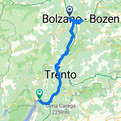
Die Königsettappe der AXS Tour de Alps 2009. Von Bozen über den Mendelpass, den Tonale, den Gaviapass nach Bormio. Von dort mit einem kurzem Abstecher auf den Umbrailpass über das Stilfser Joch mit Tibethütte (2.800 m üNN Dach der Tour) über Prad nach Mals im Vinschgau am Rechenpass.<br />
- -:--
- Duration
- 206.8 km
- Distance
- 5,224 m
- Ascent
- 4,463 m
- Descent
- ---
- Avg. speed
- ---
- Max. altitude

Continue with Bikemap
Use, edit, or download this cycling route
You would like to ride AXS Tour de Alps 2009 - Stage 10° or customize it for your own trip? Here is what you can do with this Bikemap route:
Free features
- Save this route as favorite or in collections
- Copy & plan your own version of this route
- Split it into stages to create a multi-day tour
- Sync your route with Garmin or Wahoo
Premium features
Free trial for 3 days, or one-time payment. More about Bikemap Premium.
- Navigate this route on iOS & Android
- Export a GPX / KML file of this route
- Create your custom printout (try it for free)
- Download this route for offline navigation
Discover more Premium features.
Get Bikemap PremiumFrom our community
Other popular routes starting in Andriano
 Wolfsturm nachSt.Apollonia
- Distance
- 15.1 km
- Ascent
- 3,383 m
- Descent
- 3,430 m
- Location
- Andriano, Trentino-Alto Adige, Italy
 Adrian-Vöran-Meran-Adrian
- Distance
- 60.9 km
- Ascent
- 1,433 m
- Descent
- 1,433 m
- Location
- Andriano, Trentino-Alto Adige, Italy
 2010_6_Via Claudia Augusta_Andrian - Nago
- Distance
- 141.1 km
- Ascent
- 452 m
- Descent
- 512 m
- Location
- Andriano, Trentino-Alto Adige, Italy
 Transalp Light 3. Etappe
- Distance
- 135.2 km
- Ascent
- 1,762 m
- Descent
- 1,966 m
- Location
- Andriano, Trentino-Alto Adige, Italy
 Andrian-Mendelpass-Gampenpass-Ultental
- Distance
- 103.9 km
- Ascent
- 2,114 m
- Descent
- 2,115 m
- Location
- Andriano, Trentino-Alto Adige, Italy
 Adrian-Mendelpass-Gampenjoch-Adrian
- Distance
- 81.5 km
- Ascent
- 1,697 m
- Descent
- 1,697 m
- Location
- Andriano, Trentino-Alto Adige, Italy
 Andrian - Forst - Lana - Andrian
- Distance
- 50.9 km
- Ascent
- 273 m
- Descent
- 274 m
- Location
- Andriano, Trentino-Alto Adige, Italy
 AXS Tour de Alps 2009 - Stage 10°
- Distance
- 206.8 km
- Ascent
- 5,224 m
- Descent
- 4,463 m
- Location
- Andriano, Trentino-Alto Adige, Italy
Open it in the app