

MTB Lauda 9
A cycling route starting in Lauda-Königshofen, Baden-Wurttemberg, Germany.
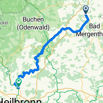
Overview
About this route
LaudaRunde-Radweg Königshofen-Sachenfur-Untrschüpf-Oberschüpf-Lengenrieden-über´n Berg nach Gräffingen-Uiffinger Windpark-Obereubigheim-Eisenbahntunnel-Ahornwald Runde-Buch-Ahorwald-Heckfelder Glocken am See-Ahornwald-entlang der BAB-Wetterkeuz-Oberlauda Altenberg-Tunneltrail-Ölberg-Lauda
- -:--
- Duration
- 49.3 km
- Distance
- 471 m
- Ascent
- 462 m
- Descent
- ---
- Avg. speed
- ---
- Max. altitude
Route quality
Waytypes & surfaces along the route
Waytypes
Track
27.4 km
(56 %)
Quiet road
11.1 km
(23 %)
Surfaces
Paved
23.9 km
(49 %)
Unpaved
16 km
(32 %)
Asphalt
15.3 km
(31 %)
Gravel
12.7 km
(26 %)
Continue with Bikemap
Use, edit, or download this cycling route
You would like to ride MTB Lauda 9 or customize it for your own trip? Here is what you can do with this Bikemap route:
Free features
- Save this route as favorite or in collections
- Copy & plan your own version of this route
- Sync your route with Garmin or Wahoo
Premium features
Free trial for 3 days, or one-time payment. More about Bikemap Premium.
- Navigate this route on iOS & Android
- Export a GPX / KML file of this route
- Create your custom printout (try it for free)
- Download this route for offline navigation
Discover more Premium features.
Get Bikemap PremiumFrom our community
Other popular routes starting in Lauda-Königshofen
 Trainingsrunde
- Distance
- 81 km
- Ascent
- 409 m
- Descent
- 394 m
- Location
- Lauda-Königshofen, Baden-Wurttemberg, Germany
 Rundtour Königshofen Beckstein
- Distance
- 29.7 km
- Ascent
- 409 m
- Descent
- 412 m
- Location
- Lauda-Königshofen, Baden-Wurttemberg, Germany
 Lauda-Tauberbrücke Erlebnistour
- Distance
- 39.7 km
- Ascent
- 343 m
- Descent
- 343 m
- Location
- Lauda-Königshofen, Baden-Wurttemberg, Germany
 Frankenrunde Tauber zum Main und zurück CLONED FROM ROUTE 288271
- Distance
- 97.4 km
- Ascent
- 846 m
- Descent
- 855 m
- Location
- Lauda-Königshofen, Baden-Wurttemberg, Germany
 MTB Lauda Römerweg-Osterloch Runde
- Distance
- 39.9 km
- Ascent
- 596 m
- Descent
- 596 m
- Location
- Lauda-Königshofen, Baden-Wurttemberg, Germany
 Lauda - Königshofen - Boxberg - Osterburken - Möckmühl - Jagsttal - BFH Schillerstr.
- Distance
- 80.8 km
- Ascent
- 266 m
- Descent
- 289 m
- Location
- Lauda-Königshofen, Baden-Wurttemberg, Germany
 MTB Lauda 07-19
- Distance
- 33.7 km
- Ascent
- 369 m
- Descent
- 363 m
- Location
- Lauda-Königshofen, Baden-Wurttemberg, Germany
 N° 1 | E-Bike Teststrecke auf den Schmachtenberg
- Distance
- 8.8 km
- Ascent
- 142 m
- Descent
- 139 m
- Location
- Lauda-Königshofen, Baden-Wurttemberg, Germany
Open it in the app