

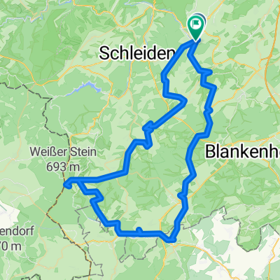
Urft - Rursee Rur-Radweg
A cycling route starting in Kall, North Rhine-Westphalia, Germany.
Overview
About this route
Die abwechslungsreich Radtour beginnt in Köln, von Bahnhof mit der Bahn fahren wir bis Kall. Geradelt wird durch Gemünd und die Urfttalsperre nach Rurberg. In Rurberg gehen wir mit den Rädern aufs Schiff. Die Fahrt ist c.a. 1 Std, wird die Zeit am Bord zum Picknick oder Kaffee und Kuchen genutzt. Von Staumauer Schwalmenauel radeln wir die Rur entlang bis Düren.
- -:--
- Duration
- 76 km
- Distance
- 962 m
- Ascent
- 1,202 m
- Descent
- ---
- Avg. speed
- 377 m
- Max. altitude

Route quality
Waytypes & surfaces along the route
Waytypes
Track
23.5 km
(31 %)
Quiet road
18.3 km
(24 %)
Surfaces
Paved
43.3 km
(57 %)
Unpaved
25.8 km
(34 %)
Asphalt
39.5 km
(52 %)
Gravel
19.4 km
(25 %)
Continue with Bikemap
Use, edit, or download this cycling route
You would like to ride Urft - Rursee Rur-Radweg or customize it for your own trip? Here is what you can do with this Bikemap route:
Free features
- Save this route as favorite or in collections
- Copy & plan your own version of this route
- Sync your route with Garmin or Wahoo
Premium features
Free trial for 3 days, or one-time payment. More about Bikemap Premium.
- Navigate this route on iOS & Android
- Export a GPX / KML file of this route
- Create your custom printout (try it for free)
- Download this route for offline navigation
Discover more Premium features.
Get Bikemap PremiumFrom our community
Other popular routes starting in Kall
 bonnloire
- Distance
- 1,098.5 km
- Ascent
- 4,281 m
- Descent
- 4,659 m
- Location
- Kall, North Rhine-Westphalia, Germany
 Rursee Runde
- Distance
- 54.7 km
- Ascent
- 916 m
- Descent
- 921 m
- Location
- Kall, North Rhine-Westphalia, Germany
 kall runde 37 km
- Distance
- 36.3 km
- Ascent
- 351 m
- Descent
- 321 m
- Location
- Kall, North Rhine-Westphalia, Germany
 Gemünd-Talsperrenrunde-Heimbach
- Distance
- 39.5 km
- Ascent
- 399 m
- Descent
- 679 m
- Location
- Kall, North Rhine-Westphalia, Germany
 Rund um Mechernich
- Distance
- 41.2 km
- Ascent
- 503 m
- Descent
- 481 m
- Location
- Kall, North Rhine-Westphalia, Germany
 Schneifel-Tour
- Distance
- 80.3 km
- Ascent
- 767 m
- Descent
- 768 m
- Location
- Kall, North Rhine-Westphalia, Germany
 Rund um die Eifel /Kall bis Kall ca. 90 km
- Distance
- 88.4 km
- Ascent
- 815 m
- Descent
- 815 m
- Location
- Kall, North Rhine-Westphalia, Germany
 Eifel route Gemünd
- Distance
- 87.2 km
- Ascent
- 1,079 m
- Descent
- 1,078 m
- Location
- Kall, North Rhine-Westphalia, Germany
Open it in the app