

Bad-Salzungen nach Oberhof
A cycling route starting in Bad Salzungen, Thuringia, Germany.
Overview
About this route
Rennsteig crossing first day.
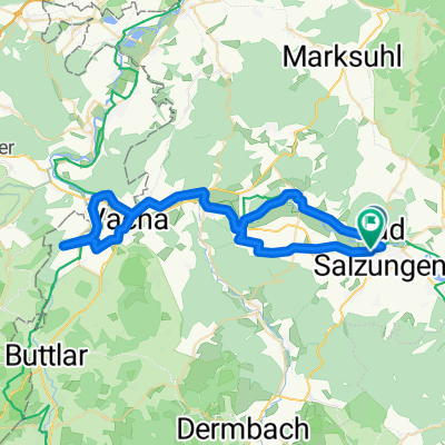
Start in Bad-Salzungen via Mommelstein cycle path. The last kilometers to Oberhof via the Rennsteig.
- -:--
- Duration
- 80.5 km
- Distance
- 1,155 m
- Ascent
- 625 m
- Descent
- ---
- Avg. speed
- ---
- Max. altitude

Continue with Bikemap
Use, edit, or download this cycling route
You would like to ride Bad-Salzungen nach Oberhof or customize it for your own trip? Here is what you can do with this Bikemap route:
Free features
- Save this route as favorite or in collections
- Copy & plan your own version of this route
- Split it into stages to create a multi-day tour
- Sync your route with Garmin or Wahoo
Premium features
Free trial for 3 days, or one-time payment. More about Bikemap Premium.
- Navigate this route on iOS & Android
- Export a GPX / KML file of this route
- Create your custom printout (try it for free)
- Download this route for offline navigation
Discover more Premium features.
Get Bikemap PremiumFrom our community
Other popular routes starting in Bad Salzungen
 BaSa - U-Bach - BaSa
- Distance
- 52.5 km
- Ascent
- 442 m
- Descent
- 441 m
- Location
- Bad Salzungen, Thuringia, Germany
 Kissel/Arnsberg-Dreiherrenstein-Steinbach/Messerweg-Bad Salzungen
- Distance
- 27.9 km
- Ascent
- 656 m
- Descent
- 278 m
- Location
- Bad Salzungen, Thuringia, Germany
 2001 Werratal Bad Salzungen bis Gerstungen
- Distance
- 48.9 km
- Ascent
- 326 m
- Descent
- 354 m
- Location
- Bad Salzungen, Thuringia, Germany
 Moorgrundrunde
- Distance
- 31.8 km
- Ascent
- 337 m
- Descent
- 337 m
- Location
- Bad Salzungen, Thuringia, Germany
 Bad Salzungen // Walnusshof; Langenfelder Str. 2 nach Tropfsteinhöhle Kittelsthal und zurück
- Distance
- 51.4 km
- Ascent
- 823 m
- Descent
- 822 m
- Location
- Bad Salzungen, Thuringia, Germany
 Pleßenduro
- Distance
- 36.3 km
- Ascent
- 910 m
- Descent
- 910 m
- Location
- Bad Salzungen, Thuringia, Germany
 Bad-Salzungen nach Oberhof
- Distance
- 80.5 km
- Ascent
- 1,155 m
- Descent
- 625 m
- Location
- Bad Salzungen, Thuringia, Germany
 Main - Alpen 17. Teil: Bad Salzungen - Wanfried
- Distance
- 74 km
- Ascent
- 357 m
- Descent
- 419 m
- Location
- Bad Salzungen, Thuringia, Germany
Open it in the app