

MwS-Lindenberg Scheidegg-Weiler Oberhäuser-Tour
A cycling route starting in Heimenkirch, Bavaria, Germany.
Overview
About this route
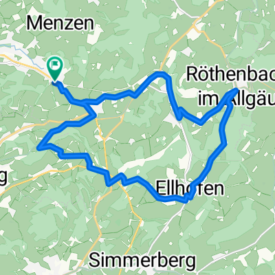
MwS-Lindenberg Scheidegg-Weiler Oberhäuser Tour
- -:--
- Duration
- 21.4 km
- Distance
- 253 m
- Ascent
- 253 m
- Descent
- ---
- Avg. speed
- ---
- Max. altitude
Route quality
Waytypes & surfaces along the route
Waytypes
Path
7.5 km
(35 %)
Cycleway
5.3 km
(25 %)
Surfaces
Paved
18.6 km
(87 %)
Unpaved
2.1 km
(10 %)
Asphalt
18.6 km
(87 %)
Gravel
1.5 km
(7 %)
Continue with Bikemap
Use, edit, or download this cycling route
You would like to ride MwS-Lindenberg Scheidegg-Weiler Oberhäuser-Tour or customize it for your own trip? Here is what you can do with this Bikemap route:
Free features
- Save this route as favorite or in collections
- Copy & plan your own version of this route
- Sync your route with Garmin or Wahoo
Premium features
Free trial for 3 days, or one-time payment. More about Bikemap Premium.
- Navigate this route on iOS & Android
- Export a GPX / KML file of this route
- Create your custom printout (try it for free)
- Download this route for offline navigation
Discover more Premium features.
Get Bikemap PremiumFrom our community
Other popular routes starting in Heimenkirch
 ALLGÄU 002: Eglofser Allgäurunde
- Distance
- 36 km
- Ascent
- 399 m
- Descent
- 400 m
- Location
- Heimenkirch, Bavaria, Germany
 Sylvia
- Distance
- 61.9 km
- Ascent
- 270 m
- Descent
- 500 m
- Location
- Heimenkirch, Bavaria, Germany
 MwS-Lindenberg Scheidegg-Weiler Oberhäuser-Tour
- Distance
- 21.4 km
- Ascent
- 253 m
- Descent
- 253 m
- Location
- Heimenkirch, Bavaria, Germany
 Ellhofen - Weiler
- Distance
- 16.9 km
- Ascent
- 268 m
- Descent
- 268 m
- Location
- Heimenkirch, Bavaria, Germany
 Aufnahme vom 27.05.2016, 13:36
- Distance
- 29.4 km
- Ascent
- 481 m
- Descent
- 824 m
- Location
- Heimenkirch, Bavaria, Germany
 Lindenberg zum Pfaender
- Distance
- 16.3 km
- Ascent
- 416 m
- Descent
- 133 m
- Location
- Heimenkirch, Bavaria, Germany
 WG-LI-Weiler-Ellhofen-Gest-Eisen
- Distance
- 27 km
- Ascent
- 481 m
- Descent
- 554 m
- Location
- Heimenkirch, Bavaria, Germany
 Westallgäu Ost
- Distance
- 54.5 km
- Ascent
- 776 m
- Descent
- 774 m
- Location
- Heimenkirch, Bavaria, Germany
Open it in the app