

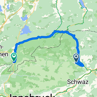
Pertisau - Achenkirch
A cycling route starting in Jenbach, Tyrol, Austria.
Overview
About this route
- -:--
- Duration
- 16.5 km
- Distance
- 233 m
- Ascent
- 250 m
- Descent
- ---
- Avg. speed
- 971 m
- Max. altitude

Route quality
Waytypes & surfaces along the route
Waytypes
Track
6.9 km
(42 %)
Quiet road
3.6 km
(22 %)
Surfaces
Paved
15.6 km
(94 %)
Unpaved
0.3 km
(2 %)
Asphalt
14.7 km
(89 %)
Paved (undefined)
0.8 km
(5 %)
Continue with Bikemap
Use, edit, or download this cycling route
You would like to ride Pertisau - Achenkirch or customize it for your own trip? Here is what you can do with this Bikemap route:
Free features
- Save this route as favorite or in collections
- Copy & plan your own version of this route
- Sync your route with Garmin or Wahoo
Premium features
Free trial for 3 days, or one-time payment. More about Bikemap Premium.
- Navigate this route on iOS & Android
- Export a GPX / KML file of this route
- Create your custom printout (try it for free)
- Download this route for offline navigation
Discover more Premium features.
Get Bikemap PremiumFrom our community
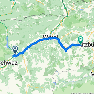
Other popular routes starting in Jenbach
 From Jenbach to Matrei am Brenner on less busy road but steeper
- Distance
- 62.9 km
- Ascent
- 1,162 m
- Descent
- 901 m
- Location
- Jenbach, Tyrol, Austria
 From Jenbach to Matrei am Brenner on busy road but less steep
- Distance
- 62.9 km
- Ascent
- 1,105 m
- Descent
- 847 m
- Location
- Jenbach, Tyrol, Austria
 Achensee 1
- Distance
- 14 km
- Ascent
- 178 m
- Descent
- 175 m
- Location
- Jenbach, Tyrol, Austria
 4 Pertisau - Mittenwald
- Distance
- 71.4 km
- Ascent
- 1,179 m
- Descent
- 1,215 m
- Location
- Jenbach, Tyrol, Austria
 1 Jenbach - Kirchberg
- Distance
- 60.4 km
- Ascent
- 683 m
- Descent
- 443 m
- Location
- Jenbach, Tyrol, Austria
 Maurach - Plumsjoch - De - Maurach
- Distance
- 84.9 km
- Ascent
- 1,115 m
- Descent
- 1,115 m
- Location
- Jenbach, Tyrol, Austria
 Slow ride in Maurach
- Distance
- 25 km
- Ascent
- 846 m
- Descent
- 848 m
- Location
- Jenbach, Tyrol, Austria
 Planbergstraße, Eben am Achensee nach Lärchenwiesenstraße, Eben am Achensee
- Distance
- 30.1 km
- Ascent
- 1,127 m
- Descent
- 1,121 m
- Location
- Jenbach, Tyrol, Austria
Open it in the app