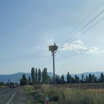
Türkeirundfahrt
Seydisehir - Sarkikaraagac
A cycling route starting in Seydişehir, Konya Province, Republic of Türkiye.
Overview
About this route
Eher flach
- -:--
- Duration
- 96.1 km
- Distance
- 416 m
- Ascent
- 362 m
- Descent
- ---
- Avg. speed
- ---
- Max. altitude
Part of
Türkeirundfahrt
12 stages
Continue with Bikemap
Use, edit, or download this cycling route
You would like to ride Seydisehir - Sarkikaraagac or customize it for your own trip? Here is what you can do with this Bikemap route:
Free features
- Save this route as favorite or in collections
- Copy & plan your own version of this route
- Split it into stages to create a multi-day tour
- Sync your route with Garmin or Wahoo
Premium features
Free trial for 3 days, or one-time payment. More about Bikemap Premium.
- Navigate this route on iOS & Android
- Export a GPX / KML file of this route
- Create your custom printout (try it for free)
- Download this route for offline navigation
Discover more Premium features.
Get Bikemap PremiumFrom our community
Other popular routes starting in Seydişehir
 karacaore Long ride through Seydişehir
- Distance
- 66.4 km
- Ascent
- 289 m
- Descent
- 292 m
- Location
- Seydişehir, Konya Province, Republic of Türkiye
 Seydişehir Köprülü Kanyon
- Distance
- 113.6 km
- Ascent
- 1,212 m
- Descent
- 2,149 m
- Location
- Seydişehir, Konya Province, Republic of Türkiye
 Kuğulu Park Caddesi to Kuğulu Park Caddesi
- Distance
- 63.7 km
- Ascent
- 1,379 m
- Descent
- 1,385 m
- Location
- Seydişehir, Konya Province, Republic of Türkiye
 Seydilehir Bostandere Sayalı Namıza Ortakaraören Lengthy ride through Seydişehir
- Distance
- 83.3 km
- Ascent
- 995 m
- Descent
- 999 m
- Location
- Seydişehir, Konya Province, Republic of Türkiye
 Mesudiye'den Oğlakçı'ya
- Distance
- 90.9 km
- Ascent
- 1,007 m
- Descent
- 1,004 m
- Location
- Seydişehir, Konya Province, Republic of Türkiye
 Seydişehir Konya Beyşehir Seydişehir
- Distance
- 208.7 km
- Ascent
- 1,352 m
- Descent
- 1,352 m
- Location
- Seydişehir, Konya Province, Republic of Türkiye
 Seydişehir - Ermenek
- Distance
- 194.7 km
- Ascent
- 2,267 m
- Descent
- 2,126 m
- Location
- Seydişehir, Konya Province, Republic of Türkiye
 SEYDİŞEHİR-KOVADA
- Distance
- 192.2 km
- Ascent
- 1,360 m
- Descent
- 1,549 m
- Location
- Seydişehir, Konya Province, Republic of Türkiye
Open it in the app


