

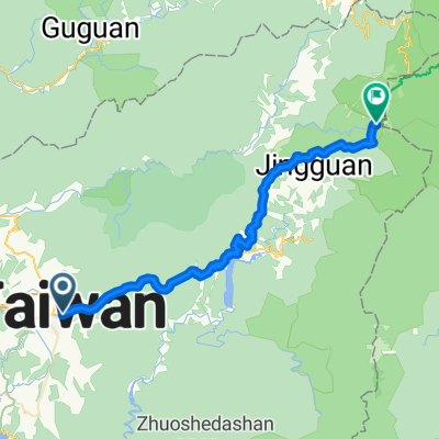
埔里地理中心碑-武嶺
A cycling route starting in Puli, Taiwan, Taiwan.
Overview
About this route
- -:--
- Duration
- 52.8 km
- Distance
- 3,551 m
- Ascent
- 1,569 m
- Descent
- ---
- Avg. speed
- 2,459 m
- Avg. speed
Route quality
Waytypes & surfaces along the route
Waytypes
Busy road
44.4 km
(84 %)
Path
4.3 km
(8 %)
Surfaces
Paved
26.7 km
(51 %)
Asphalt
26.7 km
(51 %)
Undefined
26 km
(49 %)
Continue with Bikemap
Use, edit, or download this cycling route
You would like to ride 埔里地理中心碑-武嶺 or customize it for your own trip? Here is what you can do with this Bikemap route:
Free features
- Save this route as favorite or in collections
- Copy & plan your own version of this route
- Sync your route with Garmin or Wahoo
Premium features
Free trial for 3 days, or one-time payment. More about Bikemap Premium.
- Navigate this route on iOS & Android
- Export a GPX / KML file of this route
- Create your custom printout (try it for free)
- Download this route for offline navigation
Discover more Premium features.
Get Bikemap PremiumFrom our community
Other popular routes starting in Puli
 埔里至武嶺
埔里至武嶺- Distance
- 53 km
- Ascent
- 3,534 m
- Descent
- 1,546 m
- Location
- Puli, Taiwan, Taiwan
 埔里到武嶺
埔里到武嶺- Distance
- 53.8 km
- Ascent
- 3,442 m
- Descent
- 1,313 m
- Location
- Puli, Taiwan, Taiwan
 中橫-埔里到花蓮
- Distance
- 168.4 km
- Ascent
- 3,406 m
- Descent
- 3,825 m
- Location
- Puli, Taiwan, Taiwan
 EMTB-糯米橋-芙蓉谷瀑布-阿冷坑林道-清流部落 | E-Bike Ride | Strava
- Distance
- 38.4 km
- Ascent
- 1,605 m
- Descent
- 1,606 m
- Location
- Puli, Taiwan, Taiwan
 單車遊日月潭~環潭記
- Distance
- 30.8 km
- Ascent
- 1,420 m
- Descent
- 1,418 m
- Location
- Puli, Taiwan, Taiwan
 埔里地理中心碑-武嶺
- Distance
- 52.8 km
- Ascent
- 3,551 m
- Descent
- 1,569 m
- Location
- Puli, Taiwan, Taiwan
 埔里經中橫至花蓮
- Distance
- 143.2 km
- Ascent
- 4,026 m
- Descent
- 4,439 m
- Location
- Puli, Taiwan, Taiwan
 C03 埔里-合歡山-武嶺
- Distance
- 51.6 km
- Ascent
- 3,573 m
- Descent
- 1,569 m
- Location
- Puli, Taiwan, Taiwan
Open it in the app