

Tennengebirgsrunde
A cycling route starting in Wagrain, Salzburg, Austria.
Overview
About this route
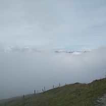
<span style="color: rgb(0, 0, 0); font-family: Verdana, Geneva, Arial, Helvetica, sans-serif; font-size: 10px; font-style: normal; font-variant: normal; font-weight: normal; letter-spacing: normal; line-height: normal; orphans: auto; text-align: start; text-indent: 0px; text-transform: none; white-space: normal; widows: auto; word-spacing: 0px; -webkit-text-stroke-width: 0px; display: inline !important; float: none;">Das Tennen- und Hagengebirge trennt das Innergebirg vom Außergebirg – das heißt das Bergvolk von den Städtern ;-).</span><br style="margin: 0px; padding: 0px; color: rgb(0, 0, 0); font-family: Verdana, Geneva, Arial, Helvetica, sans-serif; font-size: 10px; font-style: normal; font-variant: normal; font-weight: normal; letter-spacing: normal; line-height: normal; orphans: auto; text-align: start; text-indent: 0px; text-transform: none; white-space: normal; widows: auto; word-spacing: 0px; -webkit-text-stroke-width: 0px;" /> <span style="color: rgb(0, 0, 0); font-family: Verdana, Geneva, Arial, Helvetica, sans-serif; font-size: 10px; font-style: normal; font-variant: normal; font-weight: normal; letter-spacing: normal; line-height: normal; orphans: auto; text-align: start; text-indent: 0px; text-transform: none; white-space: normal; widows: auto; word-spacing: 0px; -webkit-text-stroke-width: 0px; display: inline !important; float: none;">Über die Reitdorfer Bauerndörfer nach Eben ins Fritztal. In Niedernfritz abzweigen nach St. Martin, Annaberg, Abtenau, Scheffau bis Golling. Die Fahrt durch das malerische Lammertal. Vor Golling links abbiegen in die B159. Auf halber Höhe gibt ein Blick rechts einen Teil der Salzachöfen frei. Über den Pass Lueg, nach Werfen (im Markt das 4 Sterne Restaurant der Obbauer Brüder, Burg Hohenwerfen und Eisriesenwelt als Sightseeingempfehlung), weiter nach Bischofshofen und Mitterberghütten. Gleich danach links über die Eisenbahn nach St. Johann in unsere Bezirkshauptstadt mit seinem Dom und weiter nach Wagrain</span>
- -:--
- Duration
- 102.3 km
- Distance
- 809 m
- Ascent
- 809 m
- Descent
- ---
- Avg. speed
- ---
- Avg. speed

Route quality
Waytypes & surfaces along the route
Waytypes
Busy road
84 km
(82 %)
Quiet road
6.7 km
(7 %)
Surfaces
Paved
91.2 km
(89 %)
Asphalt
91.2 km
(89 %)
Undefined
11.2 km
(11 %)
Continue with Bikemap
Use, edit, or download this cycling route
You would like to ride Tennengebirgsrunde or customize it for your own trip? Here is what you can do with this Bikemap route:
Free features
- Save this route as favorite or in collections
- Copy & plan your own version of this route
- Split it into stages to create a multi-day tour
- Sync your route with Garmin or Wahoo
Premium features
Free trial for 3 days, or one-time payment. More about Bikemap Premium.
- Navigate this route on iOS & Android
- Export a GPX / KML file of this route
- Create your custom printout (try it for free)
- Download this route for offline navigation
Discover more Premium features.
Get Bikemap PremiumFrom our community
Other popular routes starting in Wagrain
 Edelweiss hotel to Flachau to Edelweiss hotel
- Distance
- 25.8 km
- Ascent
- 2,615 m
- Descent
- 2,611 m
- Location
- Wagrain, Salzburg, Austria
 Wagrain-Reitdorf-Wagrain über Franzlalm
- Distance
- 25.7 km
- Ascent
- 1,419 m
- Descent
- 1,419 m
- Location
- Wagrain, Salzburg, Austria
 Grafenberg, Hachaualm
- Distance
- 19.9 km
- Ascent
- 977 m
- Descent
- 977 m
- Location
- Wagrain, Salzburg, Austria
 Wagrain - Floitensberg - Lackenkapelle - Wagrain
- Distance
- 24.9 km
- Ascent
- 1,742 m
- Descent
- 1,753 m
- Location
- Wagrain, Salzburg, Austria
 Ö_Salzburg_Wagrain-Ahornkarkopf-Grießenkareck_LR-20.6km-1120hm
- Distance
- 20.6 km
- Ascent
- 1,131 m
- Descent
- 1,125 m
- Location
- Wagrain, Salzburg, Austria
 Kirchboden - Jägerseestraße
- Distance
- 12.3 km
- Ascent
- 329 m
- Descent
- 135 m
- Location
- Wagrain, Salzburg, Austria
 Gründeck-Runde
- Distance
- 51.4 km
- Ascent
- 478 m
- Descent
- 477 m
- Location
- Wagrain, Salzburg, Austria
 Edelweiss hotel -Jagersee - Edelweisse hotel
- Distance
- 32.2 km
- Ascent
- 1,616 m
- Descent
- 1,626 m
- Location
- Wagrain, Salzburg, Austria
Open it in the app