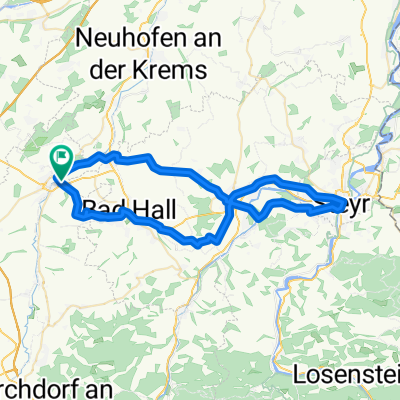
Kremsmünster - Ansfelden
A cycling route starting in Kremsmünster, Upper Austria, Austria.
Overview
About this route
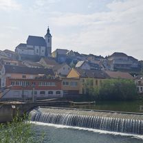
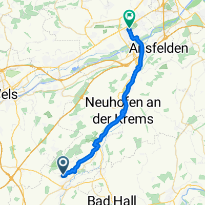
Kremsmünster - Ansfelden. Ride in the Krems Valley
- -:--
- Duration
- 24.4 km
- Distance
- 65 m
- Ascent
- 135 m
- Descent
- ---
- Avg. speed
- ---
- Max. altitude
Route quality
Waytypes & surfaces along the route
Waytypes
Quiet road
17.6 km
(72 %)
Road
2.2 km
(9 %)
Surfaces
Paved
9.5 km
(39 %)
Unpaved
2.4 km
(10 %)
Asphalt
9.5 km
(39 %)
Gravel
2.4 km
(10 %)
Undefined
12.4 km
(51 %)
Continue with Bikemap
Use, edit, or download this cycling route
You would like to ride Kremsmünster - Ansfelden or customize it for your own trip? Here is what you can do with this Bikemap route:
Free features
- Save this route as favorite or in collections
- Copy & plan your own version of this route
- Sync your route with Garmin or Wahoo
Premium features
Free trial for 3 days, or one-time payment. More about Bikemap Premium.
- Navigate this route on iOS & Android
- Export a GPX / KML file of this route
- Create your custom printout (try it for free)
- Download this route for offline navigation
Discover more Premium features.
Get Bikemap PremiumFrom our community
Other popular routes starting in Kremsmünster
Krm-TVN Traun, 27km- Distance
- 27.3 km
- Ascent
- 125 m
- Descent
- 285 m
- Location
- Kremsmünster, Upper Austria, Austria
Kremsmünster - Sipbachzell - Sattledt - Kremsmünster- Distance
- 27.8 km
- Ascent
- 185 m
- Descent
- 218 m
- Location
- Kremsmünster, Upper Austria, Austria
Kremsmünster - Ansfelden- Distance
- 24.4 km
- Ascent
- 65 m
- Descent
- 135 m
- Location
- Kremsmünster, Upper Austria, Austria
Sipbachzell - Magdalenaberg- Distance
- 50.9 km
- Ascent
- 395 m
- Descent
- 395 m
- Location
- Kremsmünster, Upper Austria, Austria
Kremsmünster - Runde- Distance
- 78.2 km
- Ascent
- 836 m
- Descent
- 837 m
- Location
- Kremsmünster, Upper Austria, Austria
Sipbachzell-Bad Hall-Kremsmünster- Distance
- 32.5 km
- Ascent
- 328 m
- Descent
- 328 m
- Location
- Kremsmünster, Upper Austria, Austria
Krift - Scheiben - Feyregg - Diepersdorf - Nußbach - Schlierbach - Wartberg - Krift- Distance
- 46.5 km
- Ascent
- 826 m
- Descent
- 825 m
- Location
- Kremsmünster, Upper Austria, Austria
Krems - Steyrtal- Distance
- 76.6 km
- Ascent
- 291 m
- Descent
- 294 m
- Location
- Kremsmünster, Upper Austria, Austria
Open it in the app


