

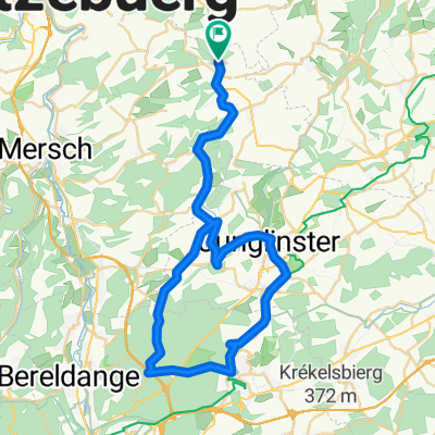
Larochette-Bettel-Bollendorf-Christnach-Larochette
A cycling route starting in Larochette, District de Luxembourg, Luxembourg.
Overview
About this route
Beautiful route along the Sauer and the Our!
- -:--
- Duration
- 55.7 km
- Distance
- 481 m
- Ascent
- 481 m
- Descent
- ---
- Avg. speed
- ---
- Max. altitude
Route quality
Waytypes & surfaces along the route
Waytypes
Road
8.3 km
(15 %)
Quiet road
1.1 km
(2 %)
Surfaces
Paved
43.4 km
(78 %)
Asphalt
42.9 km
(77 %)
Paved (undefined)
0.6 km
(1 %)
Undefined
12.2 km
(22 %)
Continue with Bikemap
Use, edit, or download this cycling route
You would like to ride Larochette-Bettel-Bollendorf-Christnach-Larochette or customize it for your own trip? Here is what you can do with this Bikemap route:
Free features
- Save this route as favorite or in collections
- Copy & plan your own version of this route
- Sync your route with Garmin or Wahoo
Premium features
Free trial for 3 days, or one-time payment. More about Bikemap Premium.
- Navigate this route on iOS & Android
- Export a GPX / KML file of this route
- Create your custom printout (try it for free)
- Download this route for offline navigation
Discover more Premium features.
Get Bikemap PremiumFrom our community
Other popular routes starting in Larochette
 Fels-Angelsberg-Nommern-Fels
- Distance
- 30.4 km
- Ascent
- 481 m
- Descent
- 481 m
- Location
- Larochette, District de Luxembourg, Luxembourg
 Chemin J-A Zinnen 29, Larochette to Chemin J-A Zinnen 29, Larochette
- Distance
- 11.6 km
- Ascent
- 268 m
- Descent
- 268 m
- Location
- Larochette, District de Luxembourg, Luxembourg
 VTT Larochette
- Distance
- 26.5 km
- Ascent
- 412 m
- Descent
- 412 m
- Location
- Larochette, District de Luxembourg, Luxembourg
 Larochette-Weiler-Vianden-Larochette
- Distance
- 70.3 km
- Ascent
- 665 m
- Descent
- 661 m
- Location
- Larochette, District de Luxembourg, Luxembourg
 Larochette-Senningerberg-Larochette
- Distance
- 46.4 km
- Ascent
- 318 m
- Descent
- 318 m
- Location
- Larochette, District de Luxembourg, Luxembourg
 Tourentipp Larochette
- Distance
- 8.1 km
- Ascent
- 201 m
- Descent
- 202 m
- Location
- Larochette, District de Luxembourg, Luxembourg
 Müllerthal light
- Distance
- 49.8 km
- Ascent
- 413 m
- Descent
- 413 m
- Location
- Larochette, District de Luxembourg, Luxembourg
 Larochette-Bettel-Bollendorf-Christnach-Larochette
- Distance
- 55.7 km
- Ascent
- 481 m
- Descent
- 481 m
- Location
- Larochette, District de Luxembourg, Luxembourg
Open it in the app