

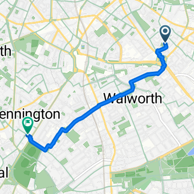
Long Way Home
A cycling route starting in Kennington, England, United Kingdom.
Overview
About this route
Work - Peckham - Dulwich - Cystal Palce - Tulse Hill - Streatham Hill clapham
- -:--
- Duration
- 24.7 km
- Distance
- 145 m
- Ascent
- 131 m
- Descent
- ---
- Avg. speed
- ---
- Max. altitude
Continue with Bikemap
Use, edit, or download this cycling route
You would like to ride Long Way Home or customize it for your own trip? Here is what you can do with this Bikemap route:
Free features
- Save this route as favorite or in collections
- Copy & plan your own version of this route
- Sync your route with Garmin or Wahoo
Premium features
Free trial for 3 days, or one-time payment. More about Bikemap Premium.
- Navigate this route on iOS & Android
- Export a GPX / KML file of this route
- Create your custom printout (try it for free)
- Download this route for offline navigation
Discover more Premium features.
Get Bikemap PremiumFrom our community
Other popular routes starting in Kennington
 East London, innit
- Distance
- 39.9 km
- Ascent
- 91 m
- Descent
- 89 m
- Location
- Kennington, England, United Kingdom
 Brighton Stammer Park
- Distance
- 78.9 km
- Ascent
- 641 m
- Descent
- 587 m
- Location
- Kennington, England, United Kingdom
 Long Way Home
- Distance
- 24.7 km
- Ascent
- 145 m
- Descent
- 131 m
- Location
- Kennington, England, United Kingdom
 Chalkpit 04
- Distance
- 82 km
- Ascent
- 686 m
- Descent
- 687 m
- Location
- Kennington, England, United Kingdom
 East Street
- Distance
- 7.9 km
- Ascent
- 21 m
- Descent
- 20 m
- Location
- Kennington, England, United Kingdom
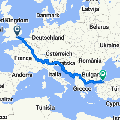 Pan_Europe
- Distance
- 4,138.8 km
- Ascent
- 6,030 m
- Descent
- 6,029 m
- Location
- Kennington, England, United Kingdom
 Prioress Street, London to Milverton Street, London
- Distance
- 2.9 km
- Ascent
- 7 m
- Descent
- 6 m
- Location
- Kennington, England, United Kingdom
 Click London - Photo Cycle Southeast LDN - June 14
- Distance
- 12.2 km
- Ascent
- 52 m
- Descent
- 51 m
- Location
- Kennington, England, United Kingdom
Open it in the app