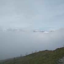
Großglockner - Edelweißspitze
A cycling route starting in Wagrain, Salzburg, Austria.
Overview
About this route
<span style="color: rgb(0, 0, 0); font-family: Verdana, Geneva, Arial, Helvetica, sans-serif; font-size: 10px; font-style: normal; font-variant: normal; font-weight: normal; letter-spacing: normal; line-height: normal; orphans: auto; text-align: start; text-indent: 0px; text-transform: none; white-space: normal; widows: auto; word-spacing: 0px; -webkit-text-stroke-width: 0px; display: inline !important; float: none;">Von Wagrain in die Bezirkshauptstadt St. Johann mit seinem Dom.</span> <span style="color: rgb(0, 0, 0); font-family: Verdana, Geneva, Arial, Helvetica, sans-serif; font-size: 10px; font-style: normal; font-variant: normal; font-weight: normal; letter-spacing: normal; line-height: normal; orphans: auto; text-align: start; text-indent: 0px; text-transform: none; white-space: normal; widows: auto; word-spacing: 0px; -webkit-text-stroke-width: 0px; display: inline !important; float: none;">Die Strecke Schwarzach, Zell am See bis Bruck an der Glocknerstrasse ist ein Kilometerfresser - 27 km. Die Großglockner Hochalpenstraße ist für Rennradfahrer mautbefreit. Die langen Kehren beim Aufstieg lassen Zeit zum Kraft tanken und die Natur und herrliche Aussicht genießen. Murmeltiere sind pfeifendes Publikum. Bis zum "Mankeiwirt" und weiter auf die Edelweißspitze heißt es durchhalten. Dort kehren wir ein und nehmen anschließend dieselbe Route als rauschende Abfahrt. Über Fusch, Bruck, Taxenbach etc. gelangen wir nahezu auf gleichem Weg wieder zurück<span class="Apple-converted-space"> </span></span>nach Wagrain.
- -:--
- Duration
- 151.3 km
- Distance
- 2,619 m
- Ascent
- 2,618 m
- Descent
- ---
- Avg. speed
- ---
- Max. altitude
Route quality
Waytypes & surfaces along the route
Waytypes
Road
75 km
(50 %)
Busy road
52.1 km
(34 %)
Surfaces
Paved
133.9 km
(88 %)
Unpaved
1.6 km
(1 %)
Asphalt
132.4 km
(88 %)
Paved (undefined)
1.4 km
(<1 %)
Continue with Bikemap
Use, edit, or download this cycling route
You would like to ride Großglockner - Edelweißspitze or customize it for your own trip? Here is what you can do with this Bikemap route:
Free features
- Save this route as favorite or in collections
- Copy & plan your own version of this route
- Split it into stages to create a multi-day tour
- Sync your route with Garmin or Wahoo
Premium features
Free trial for 3 days, or one-time payment. More about Bikemap Premium.
- Navigate this route on iOS & Android
- Export a GPX / KML file of this route
- Create your custom printout (try it for free)
- Download this route for offline navigation
Discover more Premium features.
Get Bikemap PremiumFrom our community
Other popular routes starting in Wagrain
 Edelweiss hotel -Jagersee - Edelweisse hotel
- Distance
- 32.2 km
- Ascent
- 1,616 m
- Descent
- 1,626 m
- Location
- Wagrain, Salzburg, Austria
 Grafenberg, Hachaualm
- Distance
- 19.9 km
- Ascent
- 977 m
- Descent
- 977 m
- Location
- Wagrain, Salzburg, Austria
 wagrain29
- Distance
- 29.2 km
- Ascent
- 970 m
- Descent
- 970 m
- Location
- Wagrain, Salzburg, Austria
 Edelweiss hotel to Flachau to Edelweiss hotel
- Distance
- 25.8 km
- Ascent
- 2,615 m
- Descent
- 2,611 m
- Location
- Wagrain, Salzburg, Austria
 Kirchboden - Jägerseestraße
- Distance
- 12.3 km
- Ascent
- 329 m
- Descent
- 135 m
- Location
- Wagrain, Salzburg, Austria
 Ö_Salzburg_Wagrain-Ahornkarkopf-Grießenkareck_LR-20.6km-1120hm
- Distance
- 20.6 km
- Ascent
- 1,131 m
- Descent
- 1,125 m
- Location
- Wagrain, Salzburg, Austria
 Gründeck-Runde
- Distance
- 51.4 km
- Ascent
- 478 m
- Descent
- 477 m
- Location
- Wagrain, Salzburg, Austria
 Mittelstation Flying Mozart – Bike Park Wagrain Runde
- Distance
- 10.2 km
- Ascent
- 419 m
- Descent
- 418 m
- Location
- Wagrain, Salzburg, Austria
Open it in the app


