

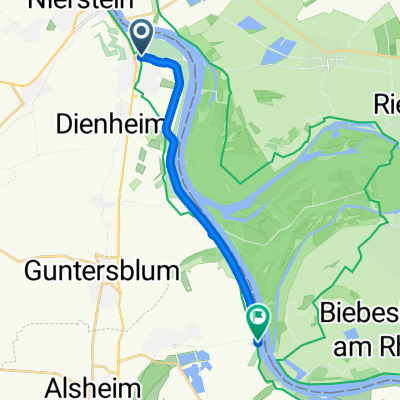
Runde ab Riedsee 45
A cycling route starting in Oppenheim, Rhineland-Palatinate, Germany.
Overview
About this route
fast training loop for Olympic distance
- -:--
- Duration
- 45.3 km
- Distance
- 41 m
- Ascent
- 41 m
- Descent
- ---
- Avg. speed
- ---
- Max. altitude
Route quality
Waytypes & surfaces along the route
Waytypes
Road
13.1 km
(29 %)
Path
9.1 km
(20 %)
Surfaces
Paved
37.6 km
(83 %)
Unpaved
0.5 km
(1 %)
Asphalt
37.1 km
(82 %)
Paved (undefined)
0.5 km
(1 %)
Continue with Bikemap
Use, edit, or download this cycling route
You would like to ride Runde ab Riedsee 45 or customize it for your own trip? Here is what you can do with this Bikemap route:
Free features
- Save this route as favorite or in collections
- Copy & plan your own version of this route
- Sync your route with Garmin or Wahoo
Premium features
Free trial for 3 days, or one-time payment. More about Bikemap Premium.
- Navigate this route on iOS & Android
- Export a GPX / KML file of this route
- Create your custom printout (try it for free)
- Download this route for offline navigation
Discover more Premium features.
Get Bikemap PremiumFrom our community
Other popular routes starting in Oppenheim
 Großer Preis von Oppenheim
- Distance
- 18.2 km
- Ascent
- 201 m
- Descent
- 211 m
- Location
- Oppenheim, Rhineland-Palatinate, Germany
 Runde ab Riedsee 45
- Distance
- 45.3 km
- Ascent
- 41 m
- Descent
- 41 m
- Location
- Oppenheim, Rhineland-Palatinate, Germany
 Rheintour Etappe 11
- Distance
- 111.5 km
- Ascent
- 380 m
- Descent
- 391 m
- Location
- Oppenheim, Rhineland-Palatinate, Germany
 Oppenheim-Ried-Gernsheim-Oppenheim
- Distance
- 49.2 km
- Ascent
- 44 m
- Descent
- 44 m
- Location
- Oppenheim, Rhineland-Palatinate, Germany
 Touren
- Distance
- 2.7 km
- Ascent
- 6 m
- Descent
- 8 m
- Location
- Oppenheim, Rhineland-Palatinate, Germany
 Mittlere Rheinrunde
- Distance
- 35.2 km
- Ascent
- 163 m
- Descent
- 162 m
- Location
- Oppenheim, Rhineland-Palatinate, Germany
 Nierstein Rheintour
- Distance
- 26.5 km
- Ascent
- 34 m
- Descent
- 36 m
- Location
- Oppenheim, Rhineland-Palatinate, Germany
 CYCLING THE RHINE: Route 14A.alt
- Distance
- 10.4 km
- Ascent
- 38 m
- Descent
- 38 m
- Location
- Oppenheim, Rhineland-Palatinate, Germany
Open it in the app