

06_Lauenbrück-Stuhr_72km
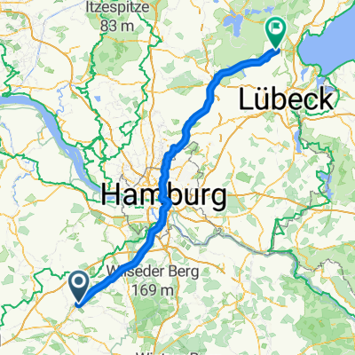
A cycling route starting in Lauenbrück, Lower Saxony, Germany.
Overview
About this route
<script language='javascript' type='text/javascript'> function SOswitchMenu() {var el = document.getElementById('bodyDiv');if ( el.style.display != 'none' ) { el.style.display = 'none';}else { el.style.display = '';}var el2 = document.getElementById('h2');if ( el2.className == 'calHeader goog-zippy-expanded normalText' ) { el2.className = 'calHeader goog-zippy-collapsed normalText';return;}if ( el2.className == 'calHeader goog-zippy-collapsed normalText' ) { el2.className = 'calHeader goog-zippy-expanded normalText';return;}}</script><script language='javascript' type='text/javascript'> function SOframeReload() {var f = document.getElementById('soFrame');f.src = f.src;}</script> <script language='javascript' type='text/javascript'> function SOswitchMenu() {var el = document.getElementById('bodyDiv');if ( el.style.display != 'none' ) { el.style.display = 'none';}else { el.style.display = '';}var el2 = document.getElementById('h2');if ( el2.className == 'calHeader goog-zippy-expanded normalText' ) { el2.className = 'calHeader goog-zippy-collapsed normalText';return;}if ( el2.className == 'calHeader goog-zippy-collapsed normalText' ) { el2.className = 'calHeader goog-zippy-expanded normalText';return;}} </script> <script language='javascript' type='text/javascript'> function SOframeReload() {var f = document.getElementById('soFrame');f.src = f.src;} </script>
- -:--
- Duration
- 72.8 km
- Distance
- 44 m
- Ascent
- 68 m
- Descent
- ---
- Avg. speed
- ---
- Max. altitude

Route quality
Waytypes & surfaces along the route
Waytypes
Quiet road
16.7 km
(23 %)
Cycleway
12.4 km
(17 %)
Surfaces
Paved
56.8 km
(78 %)
Unpaved
6.6 km
(9 %)
Asphalt
52.4 km
(72 %)
Gravel
5.1 km
(7 %)
Continue with Bikemap
Use, edit, or download this cycling route
You would like to ride 06_Lauenbrück-Stuhr_72km or customize it for your own trip? Here is what you can do with this Bikemap route:
Free features
- Save this route as favorite or in collections
- Copy & plan your own version of this route
- Sync your route with Garmin or Wahoo
Premium features
Free trial for 3 days, or one-time payment. More about Bikemap Premium.
- Navigate this route on iOS & Android
- Export a GPX / KML file of this route
- Create your custom printout (try it for free)
- Download this route for offline navigation
Discover more Premium features.
Get Bikemap PremiumFrom our community
Other popular routes starting in Lauenbrück
 Velsen - Zwolle + Zwolle - Klein Berßen (2/2) + Klein Berßen - Bremen (2/2) + Bremen - Hamburg (2/2) + Hamburg - Heiligenhafen (1/2)
- Distance
- 143.3 km
- Ascent
- 500 m
- Descent
- 489 m
- Location
- Lauenbrück, Lower Saxony, Germany
 Lauenburg -->Bremen
- Distance
- 53 km
- Ascent
- 63 m
- Descent
- 90 m
- Location
- Lauenbrück, Lower Saxony, Germany
 Stemmer Runde - Ultra
- Distance
- 17.9 km
- Ascent
- 33 m
- Descent
- 42 m
- Location
- Lauenbrück, Lower Saxony, Germany
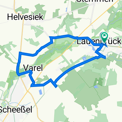
 Lauenbrück-Scheeßel-Helvesiek-Stemmen-Lauenbrück
- Distance
- 27.3 km
- Ascent
- 38 m
- Descent
- 37 m
- Location
- Lauenbrück, Lower Saxony, Germany
 Schwarzer Weg 13, Lauenbrück nach Schwarzer Weg 14, Lauenbrück
- Distance
- 15.3 km
- Ascent
- 40 m
- Descent
- 41 m
- Location
- Lauenbrück, Lower Saxony, Germany
 06_Lauenbrück-Stuhr_72km
- Distance
- 72.8 km
- Ascent
- 44 m
- Descent
- 68 m
- Location
- Lauenbrück, Lower Saxony, Germany
 Wolfenbüttel-Römö 3. Etappe
- Distance
- 76.5 km
- Ascent
- 146 m
- Descent
- 173 m
- Location
- Lauenbrück, Lower Saxony, Germany
 Ostseetour Etappe 4
- Distance
- 76.1 km
- Ascent
- 141 m
- Descent
- 172 m
- Location
- Lauenbrück, Lower Saxony, Germany
Open it in the app