- 12.7 km
- 50 m
- 49 m
- Vyškov, South Moravian, Czechia
Vejlet po neodvazové straně
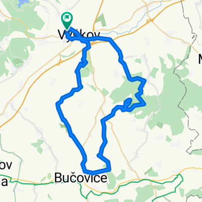
A cycling route starting in Vyškov, South Moravian, Czechia.
Overview
About this route
There was an effort to find a reasonable route on the 'non-adventurous side' (meaning that towards the highway in the direction of Lulec is adventurous, while towards Rožtěnice is non-adventurous), to find out the difference in the difficulty of the routes. This refers to road/field paths compared to routes like 'XC with forest trails' or 'Vavis is afraid of that'.
- -:--
- Duration
- 57.4 km
- Distance
- 702 m
- Ascent
- 702 m
- Descent
- ---
- Avg. speed
- ---
- Max. altitude
created this 16 years ago
Continue with Bikemap
Use, edit, or download this cycling route
You would like to ride Vejlet po neodvazové straně or customize it for your own trip? Here is what you can do with this Bikemap route:
Free features
- Save this route as favorite or in collections
- Copy & plan your own version of this route
- Sync your route with Garmin or Wahoo
Premium features
Free trial for 3 days, or one-time payment. More about Bikemap Premium.
- Navigate this route on iOS & Android
- Export a GPX / KML file of this route
- Create your custom printout (try it for free)
- Download this route for offline navigation
Discover more Premium features.
Get Bikemap PremiumFrom our community
Other popular routes starting in Vyškov
- treninková do Hamldon
- Vyškov - Rychtářov - Ruprechtov - Ježkovice - Drnovice - Vyškov II
- 31.9 km
- 387 m
- 387 m
- Vyškov, South Moravian, Czechia
- Drysický okruh
- 32.2 km
- 371 m
- 373 m
- Vyškov, South Moravian, Czechia
- Rychtářovský okruh
- 24 km
- 259 m
- 260 m
- Vyškov, South Moravian, Czechia
- Vyškov - Jedovnice a zpět:)
- 58.6 km
- 764 m
- 765 m
- Vyškov, South Moravian, Czechia
- Vyškov - Větrník - Bučovice - Orlovice - Vyškov (Jantar 2x bloudil :D )
- 51.2 km
- 672 m
- 672 m
- Vyškov, South Moravian, Czechia
- Pístovický okruh
- 27.7 km
- 433 m
- 433 m
- Vyškov, South Moravian, Czechia
- 2011/04/24 Modrá je dobrá (run.GPS)
- 45.3 km
- 695 m
- 695 m
- Vyškov, South Moravian, Czechia
Open it in the app


