

Santa Ana River bike trail imperial highway
A cycling route starting in Colton, California, United States.
Overview
About this route
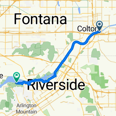
Very pleasant bike trail, starting at Hunt Lane in San Bernardino, pass through Mount Rubidoux in Riverside, a nice park, beautiful scenery along the way. Bike trail end on Arlington Ave at Norco. Partly hilly towards the end of the trail.
(cloned from route 2346977)(cloned from route 2674295)
- -:--
- Duration
- 30.3 km
- Distance
- 75 m
- Ascent
- 146 m
- Descent
- ---
- Avg. speed
- ---
- Max. altitude
Route quality
Waytypes & surfaces along the route
Waytypes
Cycleway
27.3 km
(90 %)
Track
1.8 km
(6 %)
Surfaces
Paved
11.2 km
(37 %)
Unpaved
0.9 km
(3 %)
Asphalt
11.2 km
(37 %)
Ground
0.9 km
(3 %)
Undefined
18.2 km
(60 %)
Continue with Bikemap
Use, edit, or download this cycling route
You would like to ride Santa Ana River bike trail imperial highway or customize it for your own trip? Here is what you can do with this Bikemap route:
Free features
- Save this route as favorite or in collections
- Copy & plan your own version of this route
- Sync your route with Garmin or Wahoo
Premium features
Free trial for 3 days, or one-time payment. More about Bikemap Premium.
- Navigate this route on iOS & Android
- Export a GPX / KML file of this route
- Create your custom printout (try it for free)
- Download this route for offline navigation
Discover more Premium features.
Get Bikemap PremiumFrom our community
Other popular routes starting in Colton
 💨💨+🌡
💨💨+🌡- Distance
- 61.1 km
- Ascent
- 85 m
- Descent
- 83 m
- Location
- Colton, California, United States
 Moderate route in Redlands
- Distance
- 9 km
- Ascent
- 87 m
- Descent
- 10 m
- Location
- Colton, California, United States
 S Sunwest Ct, San Bernardino to 6312 Sunfield Ct, Riverside
- Distance
- 23.2 km
- Ascent
- 325 m
- Descent
- 387 m
- Location
- Colton, California, United States
 Santa Ana river trail/San B start
- Distance
- 38.9 km
- Ascent
- 102 m
- Descent
- 100 m
- Location
- Colton, California, United States
 De 1820 S Commercenter Cir, San Bernardino a 11401 Arlington Ave, Riverside
- Distance
- 28.5 km
- Ascent
- 94 m
- Descent
- 175 m
- Location
- Colton, California, United States
 Sporty route in Colton
- Distance
- 16.5 km
- Ascent
- 244 m
- Descent
- 214 m
- Location
- Colton, California, United States
 Santa Ana River bike trail imperial highway
- Distance
- 30.3 km
- Ascent
- 75 m
- Descent
- 146 m
- Location
- Colton, California, United States
 Slow ride in Colton
- Distance
- 7.8 km
- Ascent
- 169 m
- Descent
- 152 m
- Location
- Colton, California, United States
Open it in the app