Bremervörde - Bassum
- 91.2 km
- 211 m
- 175 m
- Bremervörde, Lower Saxony, Germany
A cycling route starting in Bremervörde, Lower Saxony, Germany.
Overview
The entire East Culture Route is about 50 km long. For families who do not wish to cycle that far and would prefer to get off their bikes more often, we recommend the shorter variant (39 km). Ambitious and trained families can, of course, cycle the entire route (50 km). The starting and ending point of the tour is the town of Bremervörde, where the Vörder See with the Nature and Adventure Park offers many opportunities for discovery. From there, one cycles, through lush meadows and fields, past the grain store Nieder Ochtenhausen, towards the next family highlight. Explore the farm of the Stelling family and recharge at the Melkhus (dairy rest area) for the journey with the flat-bottomed ferry.
Along the other bank of the Oste, past the windmill Henriette in Elm, through the Horner wood you will arrive behind the wooded area at a fork. From there you can take the woodland explorer route back to Bremervörde. Or you can make a detour to the Heimathausanlage Plönjeshausen and the Historic Brickworks Pape in Bevern before returning to Bremervörde. End your day relaxed at the harbor, the pedestrian zone, by the Vörder See or at the Bachmann Museum before you head home.
Route length: 50 or 39 km
Starting point: The actual starting point of the East Culture Route is the St. Liborius Church in Bremervörde. If you are arriving by car, we recommend you choose the "Natur- und Erlebnispark Bremervörde" as your starting point due to the better and free parking options. There you can start at the "Restaurant Haus am See," where there are also public toilets. If you arrive by train, you can start your tour at St. Liborius Church. From the train station, follow Bahnhofstraße into the pedestrian zone "Brunnenstraße." Here follow the right passage to Rathausmarkt, where on the left side is St. Liborius Church.
(cloned from route 939026)
created this 11 years ago
Route highlights
Tourist-Information Bremervörde Rathausmarkt 1 27432 Bremervörde Tel. 04761/987-142 Fax 04761/987-143 Internet: www.bremervoerde.de E-Mail: touristik@bremervoerde.de Öffnungszeiten: Montag bis Freitag 10.00 Uhr bis 12.00 Uhr Montag, Dienstag, Donnerstag14.30 Uhr bis 17.00 Uhr Samstag (April bis Oktober) 10.00 Uhr bis 12.00 Uhr
Mini-Golf und Tretbootverleih
Das Café Dunkel - Eintauchen in eine völlig fremde Welt Eintauchen in eine völlig fremde Welt heißt es bei einem Besuch im Café Dunkel. Bedient von Nichtsehenden erfährt der Gast als „blinder“ Sehender, was es heißt, in völliger Dunkelheit zurechtkommen zu müssen. Sie werden erstaunt feststellen, dass sich Ihre anderen Sinne verschärfen und Sie alles intensiver erleben. Einfachste Dinge gilt es dabei zu ergründen: Wer sitzt neben mir? Wie groß ist der Raum und wie sieht er aus? Erleben Sie, wie sich Ihre Empfindungen und Wahrnehmungen verändern und lassen Sie sich Einblicke aus dem Leben der Nichtsehenden geben. Bitte rechtzeitig buchen: Das Café Dunkel öffnet nur auf Bestellung. Sonderveranstaltungen ganzjährig.
restaurierte, niedersächsische Hofanlage "Haus am See", Bremervörde
Seebühne
Wohnmobilstation - Mobil unterwegs Ruhig gelegener Stellplatz direkt am Vörder See am Kiebitzweg. Die Wohnmobilstation bietet Platz für ca. 40 Wohnmobile und steht das ganze Jahr zur Verfügung. Der Stellplatz ist eben und mit Rasengittersteinen befestigt. Alles vorhanden: gepflegte öffentliche Toilettenanlage, Ver- und Entsorgungsstation (Bodeneinlass vor Toilettenanlage, Frischwasseranschluss), Stromanschlüsse (10 Ampere), guter Empfang, Beleuchtung, Benutzerordnung am Infokasten, Infomappe mit touristischen Tipps, Serviceangebote vor Ort. Die Gebühr wird vor Ort persönlich erhoben.
Aussichtspunkt
historischer Kornspeicher, Nieder Ochtenhausen
Findorff-Haus und Findorff-Grabmal, Iselersheim
Moorhufensiedlung Ostendorf (typisches Straßendorf des Moorkolonisators Findorff)
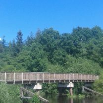
handbetriebene Prahmfähre, Gräpel
Holländer-Galerie-Windmühle "Henriette" mit Heimat- und Bäckereimuseum, Elm
Beverner Wald mit großem Wildbestand
Jagdhütte im Beverner Wald (ideal für ein Picknick)
Museumsscheune, Plönjeshausen
Historische Ziegelei Pape, Bevern
Heilig-Kreuz-Kirche, Bevern
Auepark mit "Rundweg der sprechenden Bäume", Bremervörde
Bachmann-Museum, Bremervörde
St. Liborius-Kirche
Continue with Bikemap
You would like to ride Ostekultur-Route or customize it for your own trip? Here is what you can do with this Bikemap route:
Free trial for 3 days, or one-time payment. More about Bikemap Premium.
Discover more Premium features.
Get Bikemap PremiumFrom our community
Open it in the app