

Fanitullvegen
A cycling route starting in Hemsedal, Buskerud, Norway.
Overview
About this route
<span style="font-size: 8.5pt; font-family: HelveticaNeue-HeavyCond; color: black;">Fanitullvegen</span><span style="font-size: 8.5pt; font-family: HelveticaNeue-HeavyCond; color: red;"></span>
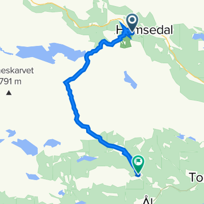
<span style="font-size: 8.5pt; font-family: HelveticaNeue-LightCond; color: black;" lang="EN-GB">Nice trail on gravel roads in the high mountain under Reineskarvet. Start from the Hemsedal Skisenter and follow the Holdeskar road (bomroad) or use the chairlift. The gravelroad ends at Leveld or Vats. From here you may follow the Stølsruta further to Ål/Hol and Geilo. We recomend also the biking trails in the Bergsjø area.</span>
<span style="color: #1f497d;"> </span>
(cloned from route 1076042)
- -:--
- Duration
- 31.5 km
- Distance
- 916 m
- Ascent
- 866 m
- Descent
- ---
- Avg. speed
- ---
- Max. altitude
Route quality
Waytypes & surfaces along the route
Waytypes
Quiet road
27.3 km
(86 %)
Road
3.1 km
(10 %)
Surfaces
Paved
2.2 km
(7 %)
Unpaved
25.6 km
(81 %)
Gravel
25.6 km
(81 %)
Asphalt
2.2 km
(7 %)
Undefined
3.7 km
(12 %)
Continue with Bikemap
Use, edit, or download this cycling route
You would like to ride Fanitullvegen or customize it for your own trip? Here is what you can do with this Bikemap route:
Free features
- Save this route as favorite or in collections
- Copy & plan your own version of this route
- Sync your route with Garmin or Wahoo
Premium features
Free trial for 3 days, or one-time payment. More about Bikemap Premium.
- Navigate this route on iOS & Android
- Export a GPX / KML file of this route
- Create your custom printout (try it for free)
- Download this route for offline navigation
Discover more Premium features.
Get Bikemap PremiumFrom our community
Other popular routes starting in Hemsedal
 Hemsedalsvegen 3533, Hemsedal do Hemsedalsvegen 3536, Hemsedal
- Distance
- 27.9 km
- Ascent
- 1,206 m
- Descent
- 1,204 m
- Location
- Hemsedal, Buskerud, Norway
 Dalløypa
- Distance
- 11.6 km
- Ascent
- 511 m
- Descent
- 511 m
- Location
- Hemsedal, Buskerud, Norway
 Hydalen
- Distance
- 12.1 km
- Ascent
- 333 m
- Descent
- 498 m
- Location
- Hemsedal, Buskerud, Norway
 Hemsedal (Holdeskaret)-Vats-Geilo
- Distance
- 70.9 km
- Ascent
- 1,071 m
- Descent
- 1,377 m
- Location
- Hemsedal, Buskerud, Norway
 Kongevegen
- Distance
- 18.4 km
- Ascent
- 1,526 m
- Descent
- 1,352 m
- Location
- Hemsedal, Buskerud, Norway
 Hemsedal
- Distance
- 52.6 km
- Ascent
- 1,042 m
- Descent
- 1,042 m
- Location
- Hemsedal, Buskerud, Norway
 Fanitullvegen
- Distance
- 31.5 km
- Ascent
- 916 m
- Descent
- 866 m
- Location
- Hemsedal, Buskerud, Norway
 Hemsedal - Ål
- Distance
- 37 km
- Ascent
- 686 m
- Descent
- 832 m
- Location
- Hemsedal, Buskerud, Norway
Open it in the app