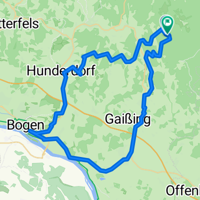
Bayerntour (Lang)
A cycling route starting in Perasdorf, Bavaria, Germany.
Overview
About this route
As with the short tour. Quite demanding as there is hardly any time to recover. The photo shows the Kostenz Monastery.
- -:--
- Duration
- 23 km
- Distance
- 629 m
- Ascent
- 623 m
- Descent
- ---
- Avg. speed
- ---
- Max. altitude
Continue with Bikemap
Use, edit, or download this cycling route
You would like to ride Bayerntour (Lang) or customize it for your own trip? Here is what you can do with this Bikemap route:
Free features
- Save this route as favorite or in collections
- Copy & plan your own version of this route
- Sync your route with Garmin or Wahoo
Premium features
Free trial for 3 days, or one-time payment. More about Bikemap Premium.
- Navigate this route on iOS & Android
- Export a GPX / KML file of this route
- Create your custom printout (try it for free)
- Download this route for offline navigation
Discover more Premium features.
Get Bikemap PremiumFrom our community
Other popular routes starting in Perasdorf
- Grandsberg 07.2015
- Distance
- 23.4 km
- Ascent
- 842 m
- Descent
- 844 m
- Location
- Perasdorf, Bavaria, Germany
- Bayerntour 2 Tour-Tag 07.2015
- Distance
- 25.4 km
- Ascent
- 817 m
- Descent
- 824 m
- Location
- Perasdorf, Bavaria, Germany
- kostenz-metten rundkurs
- Distance
- 42.1 km
- Ascent
- 869 m
- Descent
- 882 m
- Location
- Perasdorf, Bavaria, Germany
- 30.5.14 Bayerntour
- Distance
- 12.3 km
- Ascent
- 446 m
- Descent
- 450 m
- Location
- Perasdorf, Bavaria, Germany
- Gipfelfahren
- Distance
- 43.7 km
- Ascent
- 1,250 m
- Descent
- 1,254 m
- Location
- Perasdorf, Bavaria, Germany
- kostenz-metten rundkurs
- Distance
- 58.1 km
- Ascent
- 878 m
- Descent
- 1,219 m
- Location
- Perasdorf, Bavaria, Germany
- Bayerntour (Lang)
- Distance
- 23 km
- Ascent
- 629 m
- Descent
- 623 m
- Location
- Perasdorf, Bavaria, Germany
- Gipfelmarathon vord. Bayerischer Wald
- Distance
- 61.8 km
- Ascent
- 1,706 m
- Descent
- 1,706 m
- Location
- Perasdorf, Bavaria, Germany
Open it in the app