

ADFC-Hof: Tour durch die Fränkische Schweiz
A cycling route starting in Pegnitz, Bavaria, Germany.
Overview
About this route
<div class="routedescription">
Willkommen beim ADFC Kreisverband Hof Wir haben wieder ein attraktives und abwechslungsreiches Jahresprogramm für Sie zusammengestellt und laden Sie ein, mit uns auf Entdeckungstouren zu gehen. Allen, die nicht gerne allein, sondern lieber in Gesellschaft radeln wollen (nicht nur ADFC-Mitgliedern), können wir kleine und größere Ausfahrten in die nähere und weitere Umgebung von Hof anbieten. Alle Informationen dazu finden Sie unter: www.adfc-hof.de</div>
- -:--
- Duration
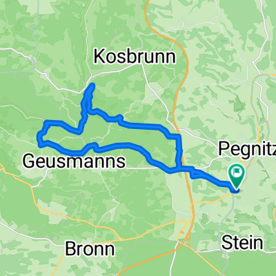
- 57.3 km
- Distance
- 453 m
- Ascent
- 455 m
- Descent
- ---
- Avg. speed
- ---
- Max. altitude

Route quality
Waytypes & surfaces along the route
Waytypes
Track
21.4 km
(37 %)
Quiet road
13.9 km
(24 %)
Surfaces
Paved
22.6 km
(39 %)
Unpaved
20.9 km
(36 %)
Asphalt
22 km
(38 %)
Gravel
18.2 km
(32 %)
Continue with Bikemap
Use, edit, or download this cycling route
You would like to ride ADFC-Hof: Tour durch die Fränkische Schweiz or customize it for your own trip? Here is what you can do with this Bikemap route:
Free features
- Save this route as favorite or in collections
- Copy & plan your own version of this route
- Sync your route with Garmin or Wahoo
Premium features
Free trial for 3 days, or one-time payment. More about Bikemap Premium.
- Navigate this route on iOS & Android
- Export a GPX / KML file of this route
- Create your custom printout (try it for free)
- Download this route for offline navigation
Discover more Premium features.
Get Bikemap PremiumFrom our community
Other popular routes starting in Pegnitz
 Pegnitz - Wander
- Distance
- 4 km
- Ascent
- 117 m
- Descent
- 115 m
- Location
- Pegnitz, Bavaria, Germany
 Rundweg Pegnitz Elbersberg Hollenberg
- Distance
- 19.2 km
- Ascent
- 332 m
- Descent
- 332 m
- Location
- Pegnitz, Bavaria, Germany
 Runde nach Königsstein
- Distance
- 56.6 km
- Ascent
- 521 m
- Descent
- 518 m
- Location
- Pegnitz, Bavaria, Germany
 Bronn-Michelfeld
- Distance
- 10.7 km
- Ascent
- 162 m
- Descent
- 176 m
- Location
- Pegnitz, Bavaria, Germany
 Pegnitz-Weiglathal-Leups-Pegnitz
- Distance
- 55.8 km
- Ascent
- 788 m
- Descent
- 786 m
- Location
- Pegnitz, Bavaria, Germany
 Veldensteiner Forst Runde
- Distance
- 45.1 km
- Ascent
- 535 m
- Descent
- 535 m
- Location
- Pegnitz, Bavaria, Germany
 Pegnitz - Bayreuth
- Distance
- 90.7 km
- Ascent
- 570 m
- Descent
- 652 m
- Location
- Pegnitz, Bavaria, Germany
 Pegnitz - Kleiner Kulm - Pegnitz
- Distance
- 14.1 km
- Ascent
- 396 m
- Descent
- 394 m
- Location
- Pegnitz, Bavaria, Germany
Open it in the app