

Col d'Izoard
A cycling route starting in Briançon, Provence-Alpes-Côte d'Azur Region, France.
Overview
About this route
Bike only day. Top half of both sides closed to motorized traffic.What a great chance to cycle one of the best climbs in the aLps in peace and quiet.
- -:--
- Duration
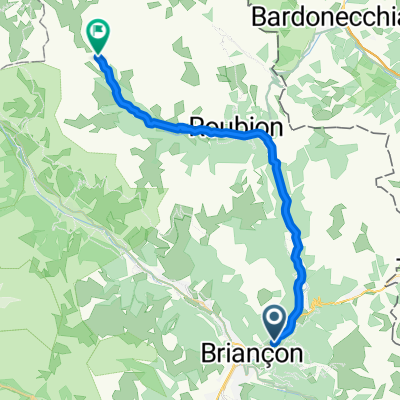
- 58.9 km
- Distance
- 1,783 m
- Ascent
- 1,787 m
- Descent
- ---
- Avg. speed
- ---
- Max. altitude

Route quality
Waytypes & surfaces along the route
Waytypes
Path
2.4 km
(4 %)
Access road
1.8 km
(3 %)
Surfaces
Paved
33.6 km
(57 %)
Asphalt
33.6 km
(57 %)
Undefined
25.3 km
(43 %)
Route highlights
Points of interest along the route
Point of interest after 37.7 km
Col d'Izoard
Continue with Bikemap
Use, edit, or download this cycling route
You would like to ride Col d'Izoard or customize it for your own trip? Here is what you can do with this Bikemap route:
Free features
- Save this route as favorite or in collections
- Copy & plan your own version of this route
- Sync your route with Garmin or Wahoo
Premium features
Free trial for 3 days, or one-time payment. More about Bikemap Premium.
- Navigate this route on iOS & Android
- Export a GPX / KML file of this route
- Create your custom printout (try it for free)
- Download this route for offline navigation
Discover more Premium features.
Get Bikemap PremiumFrom our community
Other popular routes starting in Briançon
 Col du Granon, Five Gravel Cols, Two Perched Forts
- Distance
- 72.6 km
- Ascent
- 1,887 m
- Descent
- 1,892 m
- Location
- Briançon, Provence-Alpes-Côte d'Azur Region, France
 01_Val-des-Prés bis Névache 30/900
- Distance
- 28 km
- Ascent
- 889 m
- Descent
- 141 m
- Location
- Briançon, Provence-Alpes-Côte d'Azur Region, France
 Francia Alpok negyedik nap vándor nehéz
- Distance
- 112.4 km
- Ascent
- 2,451 m
- Descent
- 2,851 m
- Location
- Briançon, Provence-Alpes-Côte d'Azur Region, France
 Izoard - Agnel + Izoard
- Distance
- 140 km
- Ascent
- 2,927 m
- Descent
- 2,931 m
- Location
- Briançon, Provence-Alpes-Côte d'Azur Region, France
 **09-D. Briançon - Lac de la Grande Léchère (157,3 Km)
- Distance
- 157.3 km
- Ascent
- 5,824 m
- Descent
- 5,355 m
- Location
- Briançon, Provence-Alpes-Côte d'Azur Region, France
 Col du Galibier via the old road
- Distance
- 52 km
- Ascent
- 1,387 m
- Descent
- 1,239 m
- Location
- Briançon, Provence-Alpes-Côte d'Azur Region, France
 Briancon - Col d`Izoard - La Roche de Rame - Briancon
- Distance
- 84 km
- Ascent
- 1,799 m
- Descent
- 1,801 m
- Location
- Briançon, Provence-Alpes-Côte d'Azur Region, France
 Col de l'Echelle
- Distance
- 20.5 km
- Ascent
- 546 m
- Descent
- 69 m
- Location
- Briançon, Provence-Alpes-Côte d'Azur Region, France
Open it in the app