

2014-07-03 Zittau-Jeschken-Isergebirge
A cycling route starting in Bogatynia, Lower Silesian Voivodeship, Poland.
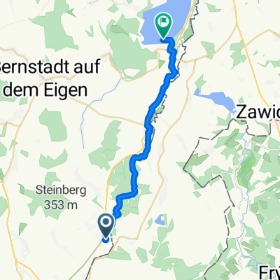
Overview
About this route
5 passes: Horni Sedlo (near Hradek) - Jeschken - Weberovka (near Bedrichov) - Krizanske Sedlo - Buk Republiky (each near Krystofovo dolí)
- -:--
- Duration
- 109.2 km
- Distance
- 1,688 m
- Ascent
- 1,691 m
- Descent
- ---
- Avg. speed
- ---
- Max. altitude

Route quality
Waytypes & surfaces along the route
Waytypes
Road
66.6 km
(61 %)
Quiet road
12 km
(11 %)
Surfaces
Paved
86.3 km
(79 %)
Unpaved
6.6 km
(6 %)
Asphalt
86.3 km
(79 %)
Gravel
3.3 km
(3 %)
Continue with Bikemap
Use, edit, or download this cycling route
You would like to ride 2014-07-03 Zittau-Jeschken-Isergebirge or customize it for your own trip? Here is what you can do with this Bikemap route:
Free features
- Save this route as favorite or in collections
- Copy & plan your own version of this route
- Split it into stages to create a multi-day tour
- Sync your route with Garmin or Wahoo
Premium features
Free trial for 3 days, or one-time payment. More about Bikemap Premium.
- Navigate this route on iOS & Android
- Export a GPX / KML file of this route
- Create your custom printout (try it for free)
- Download this route for offline navigation
Discover more Premium features.
Get Bikemap PremiumFrom our community
Other popular routes starting in Bogatynia
 Ruiny zamku w Trzcincu - punkt widokowy na kopalnię - Sieniawka - Bogatynia
- Distance
- 31.5 km
- Ascent
- 266 m
- Descent
- 264 m
- Location
- Bogatynia, Lower Silesian Voivodeship, Poland
 Neisse/Nysa/Nisa: Hirschfelde (Zittau) - Berzdorfer See
- Distance
- 19.5 km
- Ascent
- 128 m
- Descent
- 163 m
- Location
- Bogatynia, Lower Silesian Voivodeship, Poland
 Oder-Neiße-Radweg (Route D 12) 585 Km
- Distance
- 1,154.8 km
- Ascent
- 190 m
- Descent
- 431 m
- Location
- Bogatynia, Lower Silesian Voivodeship, Poland
 Hrebinek - Rozjazd Chrastava, Bedrichov, Jizera
- Distance
- 24.4 km
- Ascent
- 662 m
- Descent
- 79 m
- Location
- Bogatynia, Lower Silesian Voivodeship, Poland
 wycieczka Smedava
- Distance
- 75.9 km
- Ascent
- 1,035 m
- Descent
- 1,040 m
- Location
- Bogatynia, Lower Silesian Voivodeship, Poland
 Bogatynia - Zamek Czocha
- Distance
- 72.5 km
- Ascent
- 587 m
- Descent
- 587 m
- Location
- Bogatynia, Lower Silesian Voivodeship, Poland
 Zittau-Oybin-Görlitz.gpx
- Distance
- 70.5 km
- Ascent
- 470 m
- Descent
- 502 m
- Location
- Bogatynia, Lower Silesian Voivodeship, Poland
 kristýna-osee2
- Distance
- 7.9 km
- Ascent
- 15 m
- Descent
- 16 m
- Location
- Bogatynia, Lower Silesian Voivodeship, Poland
Open it in the app