

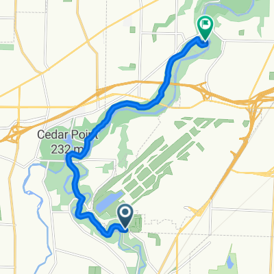
Tour of Cuyahoga Valley & Hinkley
A cycling route starting in Berea, Ohio, United States.
Overview
About this route
Tour of Metro and National Park from Berea Ohio.
- -:--
- Duration
- 87.7 km
- Distance
- 504 m
- Ascent
- 508 m
- Descent
- ---
- Avg. speed
- ---
- Max. altitude

Route quality
Waytypes & surfaces along the route
Waytypes
Road
55.3 km
(63 %)
Busy road
15.4 km
(18 %)
Surfaces
Paved
24.6 km
(28 %)
Unpaved
2.5 km
(3 %)
Asphalt
24.6 km
(28 %)
Ground
2.5 km
(3 %)
Continue with Bikemap
Use, edit, or download this cycling route
You would like to ride Tour of Cuyahoga Valley & Hinkley or customize it for your own trip? Here is what you can do with this Bikemap route:
Free features
- Save this route as favorite or in collections
- Copy & plan your own version of this route
- Split it into stages to create a multi-day tour
- Sync your route with Garmin or Wahoo
Premium features
Free trial for 3 days, or one-time payment. More about Bikemap Premium.
- Navigate this route on iOS & Android
- Export a GPX / KML file of this route
- Create your custom printout (try it for free)
- Download this route for offline navigation
Discover more Premium features.
Get Bikemap PremiumFrom our community
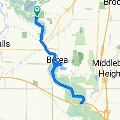
Other popular routes starting in Berea
 ms 75
ms 75- Distance
- 120.6 km
- Ascent
- 305 m
- Descent
- 365 m
- Location
- Berea, Ohio, United States
 551 Cranston Cir, Berea to 121 N La Salle St, Chicago
- Distance
- 585.5 km
- Ascent
- 313 m
- Descent
- 329 m
- Location
- Berea, Ohio, United States
 Route to South Mastick Picnic Area
- Distance
- 9 km
- Ascent
- 61 m
- Descent
- 83 m
- Location
- Berea, Ohio, United States
 Emerald Necklace Trail, Berea to Cleveland Metro Park Dr, Berea
- Distance
- 23.2 km
- Ascent
- 90 m
- Descent
- 90 m
- Location
- Berea, Ohio, United States
 Emerald Necklace Trail, Berea to 327 Prospect St, Berea
- Distance
- 11.9 km
- Ascent
- 31 m
- Descent
- 55 m
- Location
- Berea, Ohio, United States
 3rd Ride
- Distance
- 3.3 km
- Ascent
- 4 m
- Descent
- 3 m
- Location
- Berea, Ohio, United States
 3) MetroPark Willow Bend Picnic Area, Valley Parkway, Brook Park to Walter F Ehrnfelt Covered Bridge historic landmark at Whitney Rd, Strongsville
- Distance
- 16.8 km
- Ascent
- 86 m
- Descent
- 89 m
- Location
- Berea, Ohio, United States
 City Hall
- Distance
- 38 km
- Ascent
- 310 m
- Descent
- 349 m
- Location
- Berea, Ohio, United States
Open it in the app