

Waldmünchen RTF 2014
A cycling route starting in Waldmünchen, Bavaria, Germany.
Overview
About this route
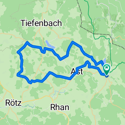
RTF Waldmünchen Tour A 2014 Sau steil
128 km
- -:--
- Duration
- 127.9 km
- Distance
- 1,322 m
- Ascent
- 1,325 m
- Descent
- ---
- Avg. speed
- ---
- Max. altitude

Route quality
Waytypes & surfaces along the route
Waytypes
Road
39.6 km
(31 %)
Quiet road
20.5 km
(16 %)
Surfaces
Paved
60.1 km
(47 %)
Unpaved
5.1 km
(4 %)
Asphalt
56.3 km
(44 %)
Paved (undefined)
3.8 km
(3 %)
Continue with Bikemap
Use, edit, or download this cycling route
You would like to ride Waldmünchen RTF 2014 or customize it for your own trip? Here is what you can do with this Bikemap route:
Free features
- Save this route as favorite or in collections
- Copy & plan your own version of this route
- Split it into stages to create a multi-day tour
- Sync your route with Garmin or Wahoo
Premium features
Free trial for 3 days, or one-time payment. More about Bikemap Premium.
- Navigate this route on iOS & Android
- Export a GPX / KML file of this route
- Create your custom printout (try it for free)
- Download this route for offline navigation
Discover more Premium features.
Get Bikemap PremiumFrom our community
Other popular routes starting in Waldmünchen
 Waldmünchen - Silbersee
- Distance
- 38.6 km
- Ascent
- 442 m
- Descent
- 454 m
- Location
- Waldmünchen, Bavaria, Germany
 Waldmünchen - Viechtach
- Distance
- 70.1 km
- Ascent
- 413 m
- Descent
- 507 m
- Location
- Waldmünchen, Bavaria, Germany
 Waldmünchner Runde 07
- Distance
- 47.1 km
- Ascent
- 501 m
- Descent
- 503 m
- Location
- Waldmünchen, Bavaria, Germany
 Waldmünchen RTF 2014
- Distance
- 127.9 km
- Ascent
- 1,322 m
- Descent
- 1,325 m
- Location
- Waldmünchen, Bavaria, Germany
 Waldmünchner Runde 06
- Distance
- 44.2 km
- Ascent
- 641 m
- Descent
- 642 m
- Location
- Waldmünchen, Bavaria, Germany
 Waldmünchner Runde 02
- Distance
- 115.5 km
- Ascent
- 1,698 m
- Descent
- 1,692 m
- Location
- Waldmünchen, Bavaria, Germany
 Pandurensteig 2. Tag Waldmünchen Cham Pfahlweg bis Regen
- Distance
- 86.8 km
- Ascent
- 1,011 m
- Descent
- 1,001 m
- Location
- Waldmünchen, Bavaria, Germany
 Waldmünchner Runde 04 - Eixendorfer See
- Distance
- 59.5 km
- Ascent
- 819 m
- Descent
- 819 m
- Location
- Waldmünchen, Bavaria, Germany
Open it in the app