

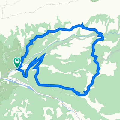
Klausenpass Rückfahrt
A cycling route starting in Muotathal, Canton of Schwyz, Switzerland.
Overview
About this route
Return from Klauenpass to Romanshorn
- -:--
- Duration
- 166.7 km
- Distance
- 1,495 m
- Ascent
- 2,929 m
- Descent
- ---
- Avg. speed
- ---
- Max. altitude
Route quality
Waytypes & surfaces along the route
Waytypes
Quiet road
10 km
(6 %)
Track
10 km
(6 %)
Surfaces
Paved
141.7 km
(85 %)
Unpaved
8.3 km
(5 %)
Asphalt
133.4 km
(80 %)
Paved (undefined)
5 km
(3 %)
Continue with Bikemap
Use, edit, or download this cycling route
You would like to ride Klausenpass Rückfahrt or customize it for your own trip? Here is what you can do with this Bikemap route:
Free features
- Save this route as favorite or in collections
- Copy & plan your own version of this route
- Split it into stages to create a multi-day tour
- Sync your route with Garmin or Wahoo
Premium features
Free trial for 3 days, or one-time payment. More about Bikemap Premium.
- Navigate this route on iOS & Android
- Export a GPX / KML file of this route
- Create your custom printout (try it for free)
- Download this route for offline navigation
Discover more Premium features.
Get Bikemap PremiumFrom our community
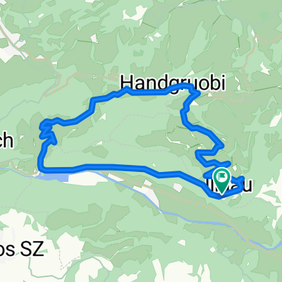
Other popular routes starting in Muotathal
 Schächental Bike
- Distance
- 55.9 km
- Ascent
- 1,916 m
- Descent
- 1,739 m
- Location
- Muotathal, Canton of Schwyz, Switzerland
 Muotathal - Uznach - Küsnacht
- Distance
- 97.1 km
- Ascent
- 1,430 m
- Descent
- 1,604 m
- Location
- Muotathal, Canton of Schwyz, Switzerland
 Route im Schneckentempo in Glarus
- Distance
- 18.9 km
- Ascent
- 69 m
- Descent
- 1,109 m
- Location
- Muotathal, Canton of Schwyz, Switzerland
 Muotathal-Weesen
- Distance
- 48.3 km
- Ascent
- 941 m
- Descent
- 1,181 m
- Location
- Muotathal, Canton of Schwyz, Switzerland
 Pragelpass_Klausenpass (ironm)
- Distance
- 67.7 km
- Ascent
- 1,797 m
- Descent
- 1,388 m
- Location
- Muotathal, Canton of Schwyz, Switzerland
 WanderWunder Schwyz: Rundwanderung Muotathal mit Plattenweg
- Distance
- 13.3 km
- Ascent
- 1,033 m
- Descent
- 1,031 m
- Location
- Muotathal, Canton of Schwyz, Switzerland
 Einsiedeln-Ibergeregg-Pragel-Schwialppass-Sattelegg
- Distance
- 74.4 km
- Ascent
- 2,266 m
- Descent
- 2,264 m
- Location
- Muotathal, Canton of Schwyz, Switzerland
 Illgau - Aufiberg
- Distance
- 14.8 km
- Ascent
- 630 m
- Descent
- 630 m
- Location
- Muotathal, Canton of Schwyz, Switzerland
Open it in the app