

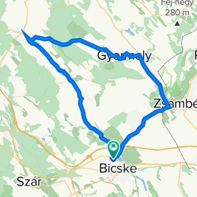
Bicske-Alcsút-Pázmánd-Velence, könnyített
A cycling route starting in Bicske, Fejér, Hungary.
Overview
About this route
Bypassing the tough climbs near Lovasberény, an easier route to Velence.
- -:--
- Duration
- 71.2 km
- Distance
- 285 m
- Ascent
- 350 m
- Descent
- ---
- Avg. speed
- ---
- Max. altitude

Route quality
Waytypes & surfaces along the route
Waytypes
Quiet road
17.1 km
(24 %)
Cycleway
5.7 km
(8 %)
Surfaces
Paved
49.8 km
(70 %)
Asphalt
49.8 km
(70 %)
Undefined
21.4 km
(30 %)
Continue with Bikemap
Use, edit, or download this cycling route
You would like to ride Bicske-Alcsút-Pázmánd-Velence, könnyített or customize it for your own trip? Here is what you can do with this Bikemap route:
Free features
- Save this route as favorite or in collections
- Copy & plan your own version of this route
- Sync your route with Garmin or Wahoo
Premium features
Free trial for 3 days, or one-time payment. More about Bikemap Premium.
- Navigate this route on iOS & Android
- Export a GPX / KML file of this route
- Create your custom printout (try it for free)
- Download this route for offline navigation
Discover more Premium features.
Get Bikemap PremiumFrom our community
Other popular routes starting in Bicske
 Kossuth utca 64, Bicske to Kossuth utca 64, Bicske
- Distance
- 43.7 km
- Ascent
- 112 m
- Descent
- 341 m
- Location
- Bicske, Fejér, Hungary
 Herceg - Bia- Felcsút 45 km Edzőkör
- Distance
- 45.8 km
- Ascent
- 324 m
- Descent
- 327 m
- Location
- Bicske, Fejér, Hungary
 Route in Felcsút
- Distance
- 101.8 km
- Ascent
- 565 m
- Descent
- 587 m
- Location
- Bicske, Fejér, Hungary
 Take me home, country road
- Distance
- 19 km
- Ascent
- 105 m
- Descent
- 77 m
- Location
- Bicske, Fejér, Hungary
 velence - vértes
- Distance
- 101.6 km
- Ascent
- 596 m
- Descent
- 597 m
- Location
- Bicske, Fejér, Hungary
 Szülinapi kör - Zoli
- Distance
- 87.8 km
- Ascent
- 633 m
- Descent
- 645 m
- Location
- Bicske, Fejér, Hungary
 Alcsúti arborétum
- Distance
- 4.8 km
- Ascent
- 38 m
- Descent
- 38 m
- Location
- Bicske, Fejér, Hungary
 Herceghalom Tata
- Distance
- 55 km
- Ascent
- 2,346 m
- Descent
- 2,367 m
- Location
- Bicske, Fejér, Hungary
Open it in the app