

Labe Tour
A cycling route starting in Szklarska Poręba, Lower Silesian Voivodeship, Poland.
Overview
About this route
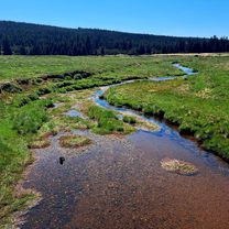
From the sources and along the Labe River to the Czech-German border.
- -:--
- Duration
- 407.1 km
- Distance
- 386 m
- Ascent
- 1,567 m
- Descent
- ---
- Avg. speed
- ---
- Max. altitude

Continue with Bikemap
Use, edit, or download this cycling route
You would like to ride Labe Tour or customize it for your own trip? Here is what you can do with this Bikemap route:
Free features
- Save this route as favorite or in collections
- Copy & plan your own version of this route
- Split it into stages to create a multi-day tour
- Sync your route with Garmin or Wahoo
Premium features
Free trial for 3 days, or one-time payment. More about Bikemap Premium.
- Navigate this route on iOS & Android
- Export a GPX / KML file of this route
- Create your custom printout (try it for free)
- Download this route for offline navigation
Discover more Premium features.
Get Bikemap PremiumFrom our community
Other popular routes starting in Szklarska Poręba
 Fluggaenkoecchicebolsen
- Distance
- 295.1 km
- Ascent
- 535 m
- Descent
- 1,069 m
- Location
- Szklarska Poręba, Lower Silesian Voivodeship, Poland
 Zgrupowanie FT - 13.05.2015
- Distance
- 49.4 km
- Ascent
- 685 m
- Descent
- 685 m
- Location
- Szklarska Poręba, Lower Silesian Voivodeship, Poland
 3 Countries v.1.
- Distance
- 390.1 km
- Ascent
- 7,596 m
- Descent
- 7,585 m
- Location
- Szklarska Poręba, Lower Silesian Voivodeship, Poland
 Jakuszyce-Chatka Górzysty-Orle-Jakuszyce
- Distance
- 22.8 km
- Ascent
- 329 m
- Descent
- 406 m
- Location
- Szklarska Poręba, Lower Silesian Voivodeship, Poland
 Szklarska Poręba - Zwalisko - Przednia Kopa- Chatka Górzystów
- Distance
- 31.5 km
- Ascent
- 619 m
- Descent
- 618 m
- Location
- Szklarska Poręba, Lower Silesian Voivodeship, Poland
 SZKLARSKA - LIBEREC/Frydlant/Świeradów - Szklarska
- Distance
- 105.8 km
- Ascent
- 1,493 m
- Descent
- 1,462 m
- Location
- Szklarska Poręba, Lower Silesian Voivodeship, Poland
 Izery
Izery- Distance
- 38.9 km
- Ascent
- 633 m
- Descent
- 634 m
- Location
- Szklarska Poręba, Lower Silesian Voivodeship, Poland
 Jakuszyce - Stóg Izerski
- Distance
- 39.3 km
- Ascent
- 731 m
- Descent
- 730 m
- Location
- Szklarska Poręba, Lower Silesian Voivodeship, Poland
Open it in the app