
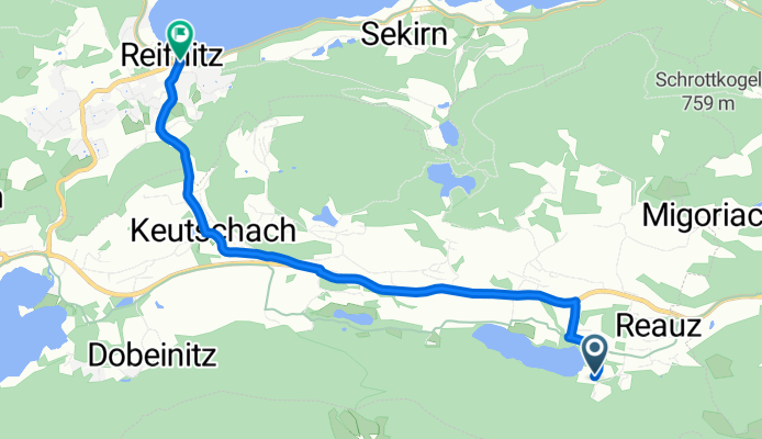
Camping Reichman-Reifnitz
A cycling route starting in Köttmannsdorf, Carinthia, Austria.
Overview
About this route
Cycle route from camping to Lake Wörther
- -:--
- Duration
- 5.7 km
- Distance
- 60 m
- Ascent
- 139 m
- Descent
- ---
- Avg. speed
- ---
- Max. altitude
Route quality
Waytypes & surfaces along the route
Waytypes
Quiet road
3.6 km
(64 %)
Access road
0.1 km
(1 %)
Surfaces
Paved
5.3 km
(94 %)
Asphalt
4.3 km
(75 %)
Paved (undefined)
1.1 km
(19 %)
Undefined
0.3 km
(6 %)
Continue with Bikemap
Use, edit, or download this cycling route
You would like to ride Camping Reichman-Reifnitz or customize it for your own trip? Here is what you can do with this Bikemap route:
Free features
- Save this route as favorite or in collections
- Copy & plan your own version of this route
- Sync your route with Garmin or Wahoo
Premium features
Free trial for 3 days, or one-time payment. More about Bikemap Premium.
- Navigate this route on iOS & Android
- Export a GPX / KML file of this route
- Create your custom printout (try it for free)
- Download this route for offline navigation
Discover more Premium features.
Get Bikemap PremiumFrom our community
Other popular routes starting in Köttmannsdorf
 UL_KL - Villach
- Distance
- 48.8 km
- Ascent
- 211 m
- Descent
- 144 m
- Location
- Köttmannsdorf, Carinthia, Austria
 test
test- Distance
- 0.7 km
- Ascent
- 0 m
- Descent
- 74 m
- Location
- Köttmannsdorf, Carinthia, Austria
 Weizelsdorf Bhf - Klagenfurter Hütte - Kosiak - Ferlach - Zell Pfarre - Schaidasattel - Eisenkappel - Gösselsdorf
- Distance
- 94.4 km
- Ascent
- 2,273 m
- Descent
- 2,234 m
- Location
- Köttmannsdorf, Carinthia, Austria
 Kappel an der Drau 27, Ferlach do Bundesstraße 10, Lambichl
- Distance
- 29.9 km
- Ascent
- 207 m
- Descent
- 143 m
- Location
- Köttmannsdorf, Carinthia, Austria
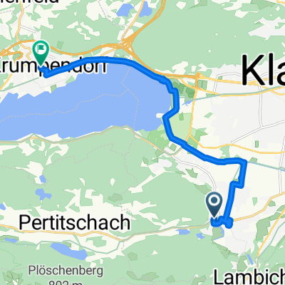
 Reauz 11 - Schrödingerstraße 88, Klagenfurt am Wörthersee
- Distance
- 10.1 km
- Ascent
- 160 m
- Descent
- 296 m
- Location
- Köttmannsdorf, Carinthia, Austria
 Weizelsdorf Bahnhof (Vorplatz), Ferlach do Kappel an der Drau 27, Ferlach
- Distance
- 28.6 km
- Ascent
- 174 m
- Descent
- 175 m
- Location
- Köttmannsdorf, Carinthia, Austria
 Woertherseerund
- Distance
- 60.5 km
- Ascent
- 1,127 m
- Descent
- 1,139 m
- Location
- Köttmannsdorf, Carinthia, Austria
 Stift-Viktring-Straße 1, Klagenfurt am Wörthersee nach Hauptstraße 157b, Krumpendorf am Wörthersee
- Distance
- 12.7 km
- Ascent
- 2,281 m
- Descent
- 2,288 m
- Location
- Köttmannsdorf, Carinthia, Austria
Open it in the app