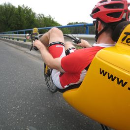
BOSNA - MONTENEGRO
A cycling route starting in Žalec, Občina Žalec, Slovenia.
Overview
About this route
HRIBOVITE LEPOTE BOSNE IN ČRNE GORE
PRIMERNO ZA AVTODOM (cloned from route 2541125)(cloned from route 2546229)
- -:--
- Duration
- 1,246.2 km
- Distance
- 5,442 m
- Ascent
- 5,200 m
- Descent
- ---
- Avg. speed
- ---
- Max. altitude
Route highlights
Points of interest along the route
Accommodation after 121.1 km
Hotel Amalia Ludbreg Trg Svetog Trojstva 26
Accommodation after 122.5 km
HOTEL BIJELA KUĆA Kolodvorska 12 48000 Koprivnica Telefon: + 385(0)48 240 320
Point of interest after 339.2 km
AVTO CAMP KRUPA NA VRBASU
Point of interest after 499.3 km
VRELO BOSNE
Accommodation after 501.8 km
AUTO CAMP OAZA Iv Viteške brigade 3 43,828307°N 18,296782°E
Point of interest after 617.8 km
PARKIRIŠČE SREDI MOSTARJA N43.343945 E17.812670
Photo after 619.3 km
STARI MOST MOSTAR 43°20'14.03"S 17°48'53.11"V
Accommodation after 629.1 km
Kamp Garten Relax 88202 Buna 43,242831°N 17,841232°E
Accommodation after 629.1 km
River Camp AGANOVAC-Blagaj N43.261242,E17.876220
Accommodation after 737.2 km
CAMP Obala Stjepana Radića 44 20235 Zaton Mali
Accommodation after 744.5 km
Camping Solitudo
Point of interest after 841.3 km
PARKIRIŠČE ZA AVTOBUSE 42.421751,18.764327
Point of interest after 877.6 km
PARKING ZA PRENOČITEV 42.379514,18.836026
Accommodation after 883.9 km
Camping Sveti Stefan
Accommodation after 892 km
Hotel Sport IN Obilica bb, 81250 Cetinje
Point of interest after 892.3 km
CETINJE PARKING 42.386815,18.926820
Accommodation after 924.7 km
Private Accommodation Gornja Gorica Rusa Radulovića 79
Accommodation after 924.7 km
Guest Accommodation Podgorica Rusa Radulovića 89
Accommodation after 929.2 km
Lake Shkodra Resort - Camping - Albania
Point of interest after 945.5 km
PRENOČIŠČE PARKING 42.53499,19.33518
Point of interest after 1,010.5 km
N42.900961 E19.595860 BIOGRADSKO JEZERO CAMP
Point of interest after 1,034.9 km
42.989519 19.410883 DOBRA HRANA NJEGOŠEV ZREZEK
Point of interest after 1,042.5 km
Dobrilovina, MANASTIR
Point of interest after 1,061.6 km
MOST NA TARI
Point of interest after 1,085.7 km
N43.153308 E19.097644 CAMP IVAN DOL
Point of interest after 1,085.9 km
AVTOCAMP KOD BOCE 43.14425,19.11202
Point of interest after 1,089.1 km
N43.122778 E19.104095 PARKIRIŠČE - SMUČIŠČE
Point of interest after 1,144.7 km
JEZ 43°16'23.25"S 18°50'31.94"V
Point of interest after 1,159.7 km
RAFTIN CENTER TARA 43.36789,18.79858
Point of interest after 1,172.9 km
DOBRA HRANA CAMP RAFTING 43.447442,18.754989
Photo after 1,240.8 km
BAŠČARŠIJA 43°51'35.17"S 18°25'52.49"V
Continue with Bikemap
Use, edit, or download this cycling route
You would like to ride BOSNA - MONTENEGRO or customize it for your own trip? Here is what you can do with this Bikemap route:
Free features
- Save this route as favorite or in collections
- Copy & plan your own version of this route
- Split it into stages to create a multi-day tour
- Sync your route with Garmin or Wahoo
Premium features
Free trial for 3 days, or one-time payment. More about Bikemap Premium.
- Navigate this route on iOS & Android
- Export a GPX / KML file of this route
- Create your custom printout (try it for free)
- Download this route for offline navigation
Discover more Premium features.
Get Bikemap PremiumFrom our community
Other popular routes starting in Žalec
 Maraton Zelene doline
- Distance
- 68.5 km
- Ascent
- 1,225 m
- Descent
- 741 m
- Location
- Žalec, Občina Žalec, Slovenia
 Usrano jezero
- Distance
- 698.3 km
- Ascent
- 502 m
- Descent
- 475 m
- Location
- Žalec, Občina Žalec, Slovenia
 Cesta na Lavo 11b to Gorica pri Šmartnem 16
- Distance
- 26.2 km
- Ascent
- 320 m
- Descent
- 311 m
- Location
- Žalec, Občina Žalec, Slovenia
 PO DOLENJSKEM
- Distance
- 361.3 km
- Ascent
- 2,296 m
- Descent
- 2,296 m
- Location
- Žalec, Občina Žalec, Slovenia
 PO DOLENJSKEM
- Distance
- 356.6 km
- Ascent
- 2,290 m
- Descent
- 2,290 m
- Location
- Žalec, Občina Žalec, Slovenia
 TURA 2024 VIŠARJE
- Distance
- 478.3 km
- Ascent
- 8,471 m
- Descent
- 8,469 m
- Location
- Žalec, Občina Žalec, Slovenia
 Kolesarjenje po Spodnji Savinjski dolini
- Distance
- 50.6 km
- Ascent
- 269 m
- Descent
- 269 m
- Location
- Žalec, Občina Žalec, Slovenia
 HopsNaHom
- Distance
- 22.3 km
- Ascent
- 422 m
- Descent
- 419 m
- Location
- Žalec, Občina Žalec, Slovenia
Open it in the app


