
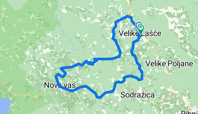
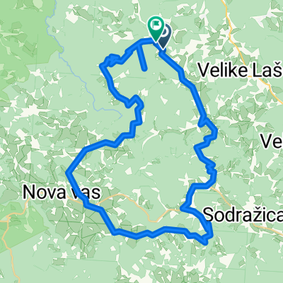
V.Lašče-Nova vas-Sv.Gregor
A cycling route starting in Velike Lašče, Občina Velike Lašče, Slovenia.
Overview
About this route
V.Lašče-Volčje jezero-Nova Vas-Žimarice-Sv.Gregor-V.Lašče
- -:--
- Duration
- 44.2 km
- Distance
- 650 m
- Ascent
- 657 m
- Descent
- ---
- Avg. speed
- ---
- Max. altitude

Route quality
Waytypes & surfaces along the route
Waytypes
Road
25.2 km
(57 %)
Quiet road
6.2 km
(14 %)
Undefined
12.8 km
(29 %)
Surfaces
Paved
39.8 km
(90 %)
Asphalt
35.8 km
(81 %)
Paved (undefined)
4 km
(9 %)
Undefined
4.4 km
(10 %)
Continue with Bikemap
Use, edit, or download this cycling route
You would like to ride V.Lašče-Nova vas-Sv.Gregor or customize it for your own trip? Here is what you can do with this Bikemap route:
Free features
- Save this route as favorite or in collections
- Copy & plan your own version of this route
- Sync your route with Garmin or Wahoo
Premium features
Free trial for 3 days, or one-time payment. More about Bikemap Premium.
- Navigate this route on iOS & Android
- Export a GPX / KML file of this route
- Create your custom printout (try it for free)
- Download this route for offline navigation
Discover more Premium features.
Get Bikemap PremiumFrom our community
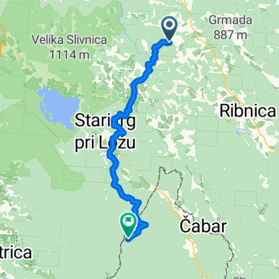
Other popular routes starting in Velike Lašče
 AŠČE,ZDENv.LSKA VAS,LJ,POD TURJAK,V.LAŠČE
- Distance
- 61 km
- Ascent
- 411 m
- Descent
- 410 m
- Location
- Velike Lašče, Občina Velike Lašče, Slovenia
 kLANCI
- Distance
- 63.3 km
- Ascent
- 710 m
- Descent
- 713 m
- Location
- Velike Lašče, Občina Velike Lašče, Slovenia
 V.Lašče-Nova vas-Sv.Gregor
- Distance
- 44.2 km
- Ascent
- 650 m
- Descent
- 657 m
- Location
- Velike Lašče, Občina Velike Lašče, Slovenia
 Velike Lašče - Klana
- Distance
- 44.5 km
- Ascent
- 1,339 m
- Descent
- 1,025 m
- Location
- Velike Lašče, Občina Velike Lašče, Slovenia
 Rob - Rob 50 km
- Distance
- 49.3 km
- Ascent
- 1,644 m
- Descent
- 1,648 m
- Location
- Velike Lašče, Občina Velike Lašče, Slovenia
 From Trubar to Cankar and back CLASSIC
- Distance
- 112.3 km
- Ascent
- 734 m
- Descent
- 734 m
- Location
- Velike Lašče, Občina Velike Lašče, Slovenia
 Rob - Rob 29km circle
- Distance
- 29 km
- Ascent
- 1,083 m
- Descent
- 1,153 m
- Location
- Velike Lašče, Občina Velike Lašče, Slovenia
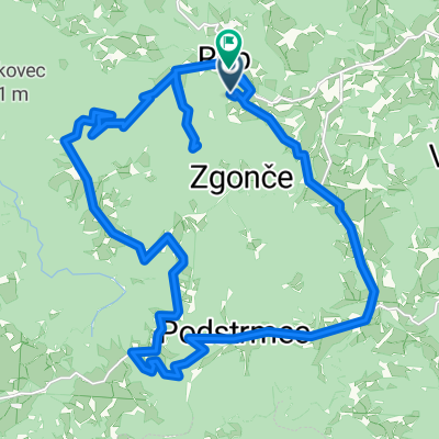
 Logarji - Sv. Primož (Zgonče)
- Distance
- 3.7 km
- Ascent
- 359 m
- Descent
- 73 m
- Location
- Velike Lašče, Občina Velike Lašče, Slovenia
Open it in the app