

Soboth - Weinebene
A cycling route starting in Hollenegg, Styria, Austria.
Overview
About this route
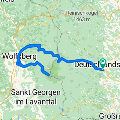
Deutschalndsberg- Weinebene- Wolfsberg-Soboth-Eibiswald-Deutschlandsberg
- -:--
- Duration
- 129 km
- Distance
- 2,477 m
- Ascent
- 2,477 m
- Descent
- ---
- Avg. speed
- ---
- Max. altitude
Route quality
Waytypes & surfaces along the route
Waytypes
Busy road
113.2 km
(88 %)
Cycleway
8 km
(6 %)
Surfaces
Paved
100.5 km
(78 %)
Asphalt
99.2 km
(77 %)
Paved (undefined)
1.2 km
(<1 %)
Continue with Bikemap
Use, edit, or download this cycling route
You would like to ride Soboth - Weinebene or customize it for your own trip? Here is what you can do with this Bikemap route:
Free features
- Save this route as favorite or in collections
- Copy & plan your own version of this route
- Split it into stages to create a multi-day tour
- Sync your route with Garmin or Wahoo
Premium features
Free trial for 3 days, or one-time payment. More about Bikemap Premium.
- Navigate this route on iOS & Android
- Export a GPX / KML file of this route
- Create your custom printout (try it for free)
- Download this route for offline navigation
Discover more Premium features.
Get Bikemap PremiumFrom our community
Other popular routes starting in Hollenegg
 Deutschlandsberg - Gardersee 2
- Distance
- 522.4 km
- Ascent
- 1,300 m
- Descent
- 1,624 m
- Location
- Hollenegg, Styria, Austria
 46.787° N 15.221° W nach 46.751° N 15.066° W
- Distance
- 27 km
- Ascent
- 1,652 m
- Descent
- 803 m
- Location
- Hollenegg, Styria, Austria
 Wolfgangiweg 61, Deutschlandsberg nach Wolfgangiweg 61, Deutschlandsberg
- Distance
- 20.5 km
- Ascent
- 452 m
- Descent
- 439 m
- Location
- Hollenegg, Styria, Austria
 Deutschlandsberg-Weinebene-Hebalm-Freiland
- Distance
- 100.2 km
- Ascent
- 2,271 m
- Descent
- 2,271 m
- Location
- Hollenegg, Styria, Austria
 Soboth - Weinebene
- Distance
- 129 km
- Ascent
- 2,477 m
- Descent
- 2,477 m
- Location
- Hollenegg, Styria, Austria
 Deutschlandsberg - Weinebene
- Distance
- 22.8 km
- Ascent
- 1,336 m
- Descent
- 84 m
- Location
- Hollenegg, Styria, Austria
 BikeComputer Aufnahme
- Distance
- 5.3 km
- Ascent
- 66 m
- Descent
- 133 m
- Location
- Hollenegg, Styria, Austria
 Speikogel ab Deutschlandsberg
- Distance
- 126.9 km
- Ascent
- 4,195 m
- Descent
- 4,196 m
- Location
- Hollenegg, Styria, Austria
Open it in the app