

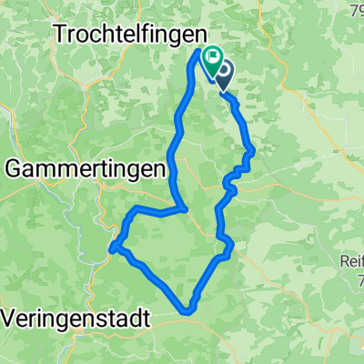
Tour 5 | Schafe, Honig und Schwarzwurst
A cycling route starting in Pfronstetten, Baden-Wurttemberg, Germany.
Overview
About this route
From Pfronstetten via Geisingen to Hochberg. Then continue via Zwiefalten, Wimsen back to Pfronstetten.
- -:--
- Duration
- 29.8 km
- Distance
- 387 m
- Ascent
- 391 m
- Descent
- ---
- Avg. speed
- ---
- Max. altitude

Route quality
Waytypes & surfaces along the route
Waytypes
Track
18.2 km
(61 %)
Quiet road
2.7 km
(9 %)
Surfaces
Paved
12.2 km
(41 %)
Unpaved
14.3 km
(48 %)
Gravel
12.2 km
(41 %)
Asphalt
7.8 km
(26 %)
Route highlights
Points of interest along the route

Point of interest after 5.9 km

Point of interest after 7.7 km
<strong>Familie Fischer</strong></br> Kettenackerstraße 54/1 </br> 72539 Pfronstetten- Geisingen </br> Tel: 07373 1307 oder </br> Tel: 07373 1508</br>

Point of interest after 10.9 km

Point of interest after 11.6 km
<strong>Hof Münch</strong></br> Walter + Pia Münch</br> Hochberg 29</br> 88529 Zwiefalten-Hochberg</br> Tel.: 07373 91 52 18</br>

Point of interest after 13.5 km

Point of interest after 19.1 km
Schloss Ehrenfels

Point of interest after 19.3 km
Das Naturtheater Hayingen garantiert Abwechslung. Spezielle Stücke für Erwachsene und Kinder sorgen für den kulturellen Aspekt mit großem Unterhaltungswert.</br> <strong>Naturtheater Hayingen</strong></br> Am Naturtheaterweg 1</br> 72534 Hayingen

Point of interest after 20.7 km
Glastalhöhle

Point of interest after 24.8 km

Point of interest after 27.8 km
<strong>Phänopfad Pfronstetten </strong></br> Der Phänopfad beginnt an der Aichelaubrücke. Die liegt zwischen Pfronstetten und Aichelau in Richtung Münsingen.

Point of interest after 29.7 km
<strong>Schäferei Fauser</strong></br> 72539 Pfronstetten </br> 07388 1281 </br> 0162 4787341
Continue with Bikemap
Use, edit, or download this cycling route
You would like to ride Tour 5 | Schafe, Honig und Schwarzwurst or customize it for your own trip? Here is what you can do with this Bikemap route:
Free features
- Save this route as favorite or in collections
- Copy & plan your own version of this route
- Sync your route with Garmin or Wahoo
Premium features
Free trial for 3 days, or one-time payment. More about Bikemap Premium.
- Navigate this route on iOS & Android
- Export a GPX / KML file of this route
- Create your custom printout (try it for free)
- Download this route for offline navigation
Discover more Premium features.
Get Bikemap PremiumFrom our community
Other popular routes starting in Pfronstetten
 Einfache Fahrt in Hohenstein
- Distance
- 7.9 km
- Ascent
- 267 m
- Descent
- 261 m
- Location
- Pfronstetten, Baden-Wurttemberg, Germany
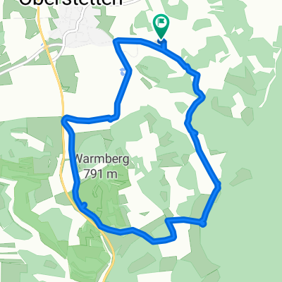
 Oberstetten-Kettenacker-Zwiefalten-Phäno
- Distance
- 51.7 km
- Ascent
- 1,185 m
- Descent
- 1,185 m
- Location
- Pfronstetten, Baden-Wurttemberg, Germany
 Barbaraweg 4, Hohenstein to Am Hochberg 25, Lauterach
- Distance
- 28.8 km
- Ascent
- 336 m
- Descent
- 1,096 m
- Location
- Pfronstetten, Baden-Wurttemberg, Germany
 Ehestetten Dapfen Bichishausen
- Distance
- 38.5 km
- Ascent
- 292 m
- Descent
- 351 m
- Location
- Pfronstetten, Baden-Wurttemberg, Germany
 K6739 nach K6739
- Distance
- 34.4 km
- Ascent
- 484 m
- Descent
- 490 m
- Location
- Pfronstetten, Baden-Wurttemberg, Germany
 Marbach Glastal-Donau-Lautertal
- Distance
- 54.9 km
- Ascent
- 784 m
- Descent
- 810 m
- Location
- Pfronstetten, Baden-Wurttemberg, Germany
 От B312, Hohenstein до Kirchstraße 2, Hohenstein
- Distance
- 1.9 km
- Ascent
- 82 m
- Descent
- 47 m
- Location
- Pfronstetten, Baden-Wurttemberg, Germany
 Kettenacker-Wimsener Höhle, Rennrad
- Distance
- 47.3 km
- Ascent
- 455 m
- Descent
- 458 m
- Location
- Pfronstetten, Baden-Wurttemberg, Germany
Open it in the app