

Waldwege4
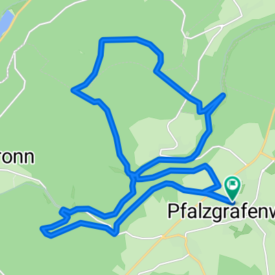
A cycling route starting in Pfalzgrafenweiler, Baden-Wurttemberg, Germany.
Overview
About this route
Eine "Tor-"tour, die einen sehr langen Anstieg nach dem Sportplatz in Durrweiler hat. Hier heißt es: Kräfte einteilen. Es kommt nämlich nur eine kurze Abfahrt und dann gehts nach der Unterführung von der B28 gleich wieder hoch. Nicht ganz so lang, aber der Puls steigt trotzdem. Danach gehts stetig bergab oder eben.
Die Wege sind hier überall gut ausgebaut.- -:--
- Duration
- 13.9 km
- Distance
- 167 m
- Ascent
- 165 m
- Descent
- ---
- Avg. speed
- ---
- Max. altitude

Route quality
Waytypes & surfaces along the route
Waytypes
Track
11.5 km
(83 %)
Quiet road
2.4 km
(17 %)
Surfaces
Paved
5.3 km
(38 %)
Unpaved
7.3 km
(53 %)
Gravel
4.4 km
(32 %)
Asphalt
2.8 km
(20 %)
Continue with Bikemap
Use, edit, or download this cycling route
You would like to ride Waldwege4 or customize it for your own trip? Here is what you can do with this Bikemap route:
Free features
- Save this route as favorite or in collections
- Copy & plan your own version of this route
- Sync your route with Garmin or Wahoo
Premium features
Free trial for 3 days, or one-time payment. More about Bikemap Premium.
- Navigate this route on iOS & Android
- Export a GPX / KML file of this route
- Create your custom printout (try it for free)
- Download this route for offline navigation
Discover more Premium features.
Get Bikemap PremiumFrom our community
Other popular routes starting in Pfalzgrafenweiler
 De Steinachring 49, Pfalzgrafenweiler a Steinachring 49, Pfalzgrafenweiler
- Distance
- 20.2 km
- Ascent
- 210 m
- Descent
- 210 m
- Location
- Pfalzgrafenweiler, Baden-Wurttemberg, Germany
 Edelweiler - Spielberg - Altensteig
- Distance
- 23.7 km
- Ascent
- 342 m
- Descent
- 342 m
- Location
- Pfalzgrafenweiler, Baden-Wurttemberg, Germany
 Waldwege1
- Distance
- 12.2 km
- Ascent
- 143 m
- Descent
- 143 m
- Location
- Pfalzgrafenweiler, Baden-Wurttemberg, Germany
 2 Burgen Tour
- Distance
- 11.8 km
- Ascent
- 141 m
- Descent
- 141 m
- Location
- Pfalzgrafenweiler, Baden-Wurttemberg, Germany
 Edelweiler eingekreist
- Distance
- 20.8 km
- Ascent
- 276 m
- Descent
- 276 m
- Location
- Pfalzgrafenweiler, Baden-Wurttemberg, Germany
 Nagoldtalsperre
- Distance
- 30.7 km
- Ascent
- 504 m
- Descent
- 504 m
- Location
- Pfalzgrafenweiler, Baden-Wurttemberg, Germany
 Waldwege4
- Distance
- 13.9 km
- Ascent
- 167 m
- Descent
- 165 m
- Location
- Pfalzgrafenweiler, Baden-Wurttemberg, Germany
 Radeln und Baden 2
- Distance
- 12.4 km
- Ascent
- 121 m
- Descent
- 119 m
- Location
- Pfalzgrafenweiler, Baden-Wurttemberg, Germany
Open it in the app