
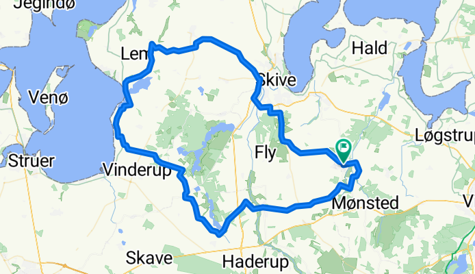

Route in Stoholm Jylland
- 23.9 km
- 136 m
- 138 m
- Stoholm, Central Jutland, Denmark
From Stoholm in calm and peace, max 25 km/h. We ride along Vestergade-Tastumvej-Tastum-Travbanen. At the roundabout with the golden ball, we stop and form riding groups 1 and 2 and short and long. The long group goes from here via Bjørnevej-Væselvej-Ringvej south-Herningvej-Ballingvej-Hem-Skivevej-Vollingvej-Ramsing-Ågade-Møllegade-Engvej-Vejby-Bustrupvej-Bustrup Efterskole-Sønder Lemvej-Hostrup-Hostrupvej-Geddal enge-Torndalvej-Ejsingholm-Ejsingholmvej-Råstvej-Råst-Landtingvej-Ålskovvej-Ål-Sahl church-Hjerl Hede-Sevel-Djeldvej-Nautrupvej-Bjergbyvej-Trevældvej-Tingvej-Dueholmvej-Åbakken-Vridsted-Vroue-Lånum-Korsvang dairy-Smollerup church-Toftum blacksmith (where the Mønsted people are dropped off)-Toftum-Gammelstrup-Stoholm.
Road
57.4 km66 %Quiet road
13.9 km16 %Undefined
15.7 km18 %Paved
85.3 km(98 %)Asphalt
85.3 km98 %Undefined
1.7 km2 %Free trial for 3 days, or one-time payment. More about Bikemap Premium.
Discover more Premium features.
Get Bikemap PremiumOpen it in the app


